I stood in awe as the Moon eclipsed the Sun on April 8. I thought I was prepared for the experience. I was not.
The Moon’s shadow covers portions of Canada and the U.S. on April 8, 2024 as seen from the International Space Station. When this photo was taken, I stood agape in the eclipse’s path of totality. The view looks east. Maine and New Brunswick are centered under the Moon’s shadow. The Saint Lawrence Seaway is the wedge of water at left and slightly below the Moon’s shadow. The Atlantic Ocean occupies the top section of Earth. Photo courtesy of NASA.
Viewing totality of the eclipse was one of the most amazing experiences of my life. Please read more in my most recent post on explore.org.
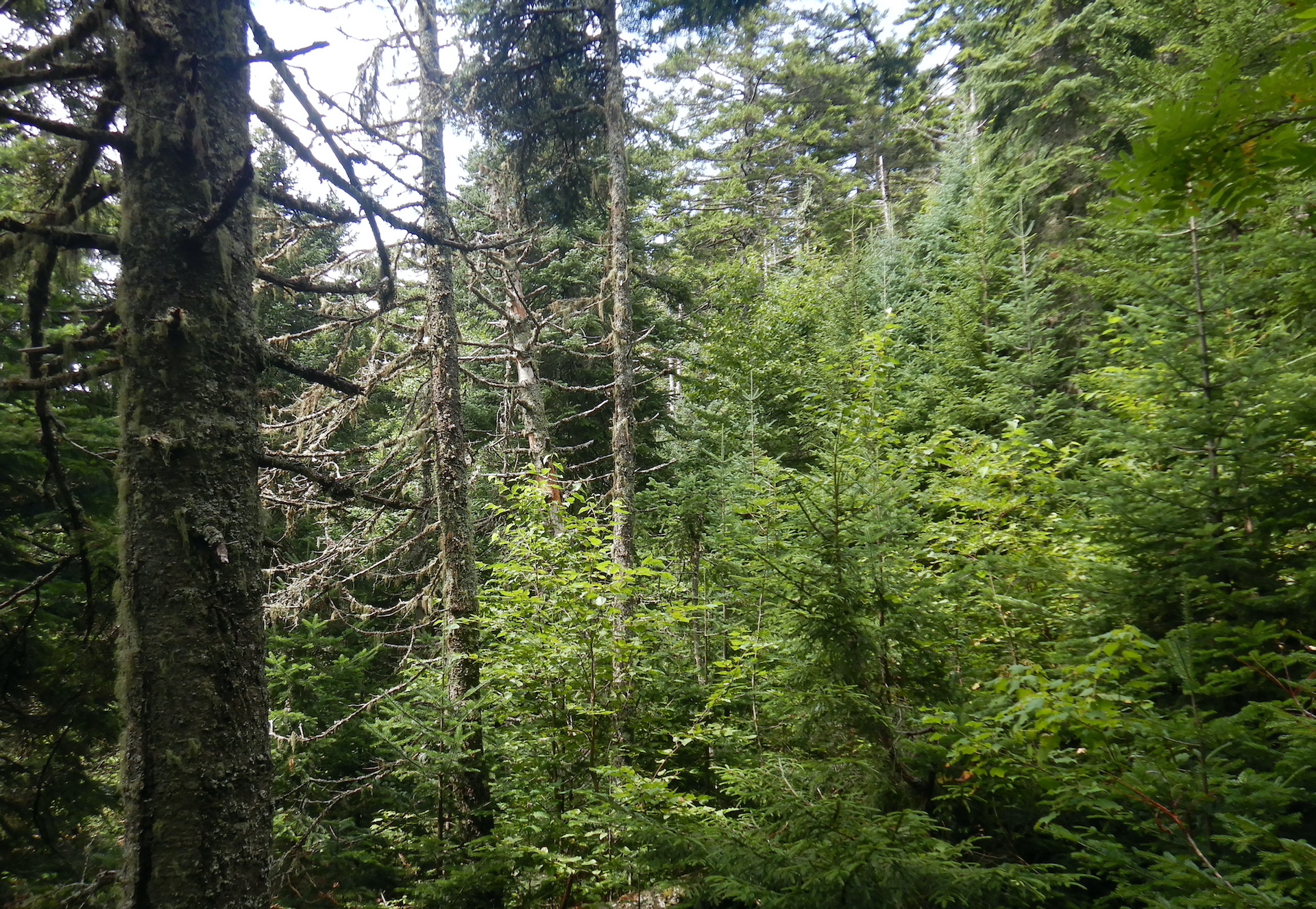
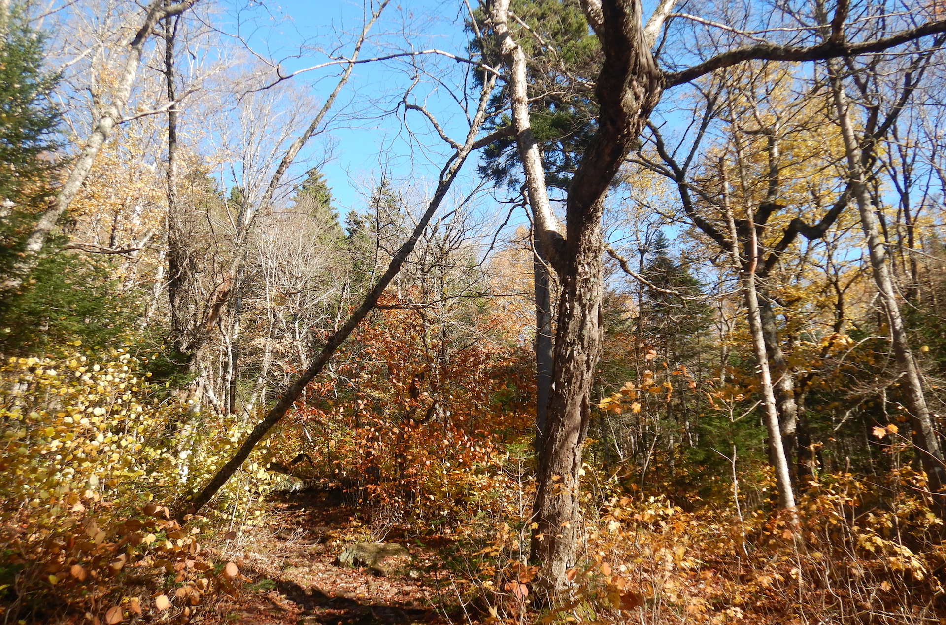
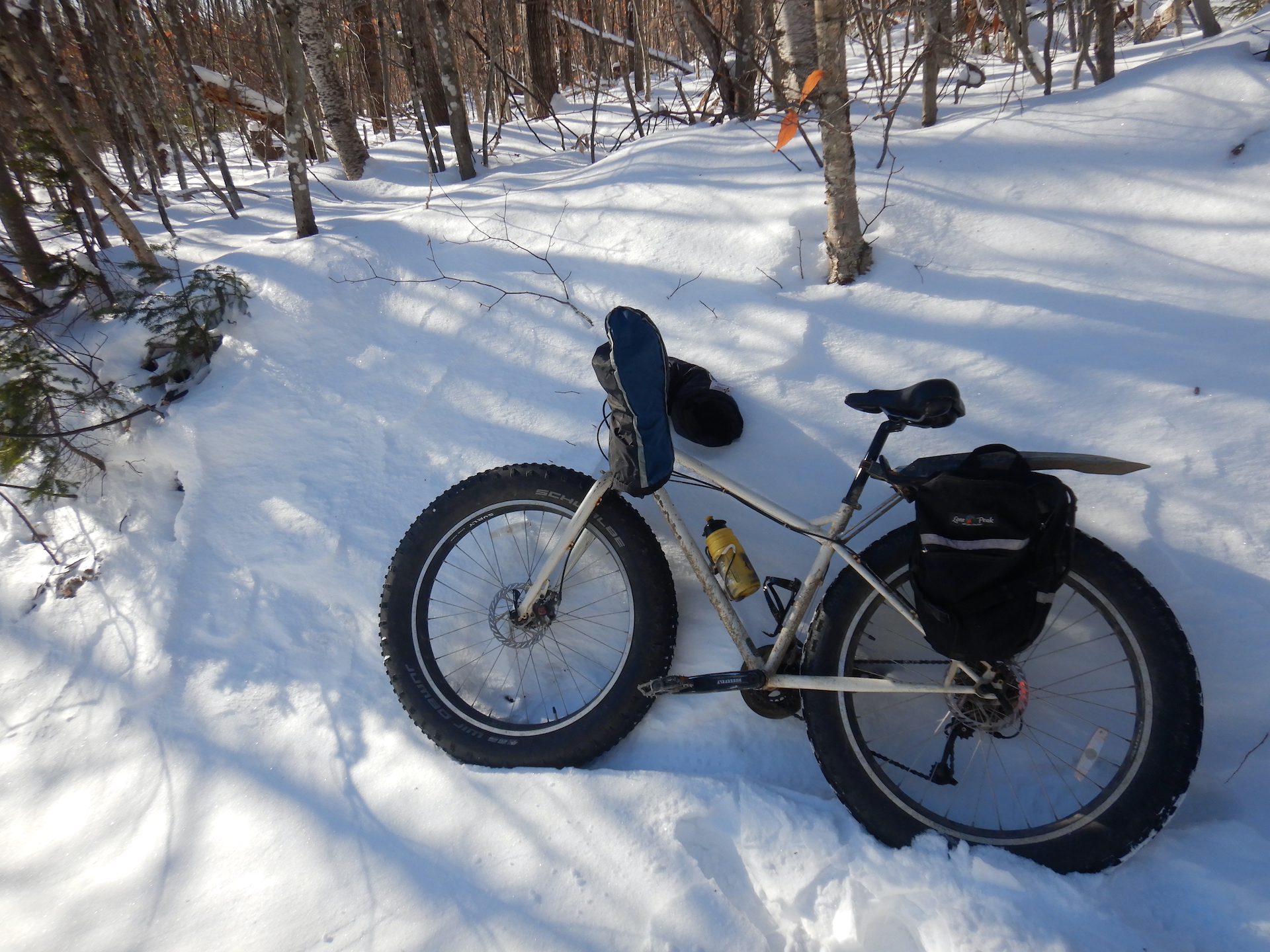
Compared to summer, winter can seem like a dull companion, especially in my corner of the globe. The buzzing of insects ceased months ago. The forest floor rests under one to three feet of snow. Trees, shrubs, invertebrates, amphibians, and fungi lie dormant. Ice insulates wetlands that were vibrating with life not long ago. Migrating birds vanished months ago. Then, there’s the dangers posed by cold weather. Numbed toes and fingers aren’t pleasant, nor are the perpetual threats of frostbite and hypothermia. All-in-all, I could convince myself that winter is a season to be endured rather than embraced. This would be a mistake, though.
While I miss the sheer volume of aliveness that accompanies summertime, winter has many endearing qualities. It helps me appreciate the abundance of summer. Off-trail travel is often easier when wetlands are frozen and snow smooths the terrain. And few experiences are as peaceful as the immense quiet that accompanies a snowstorm in an isolated grove of trees.
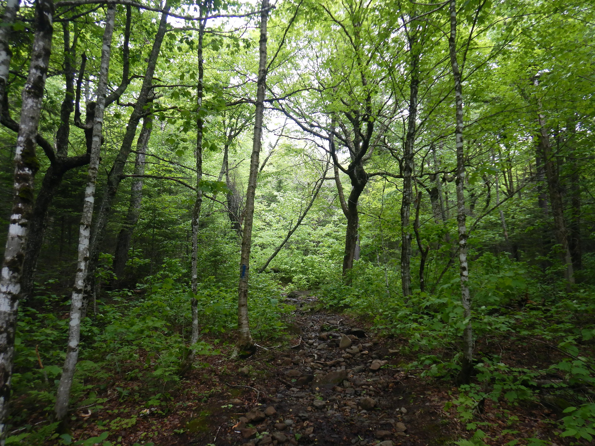
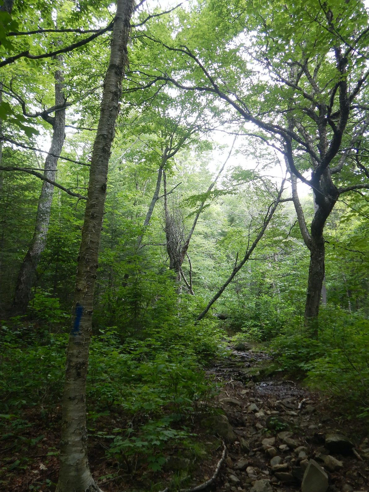
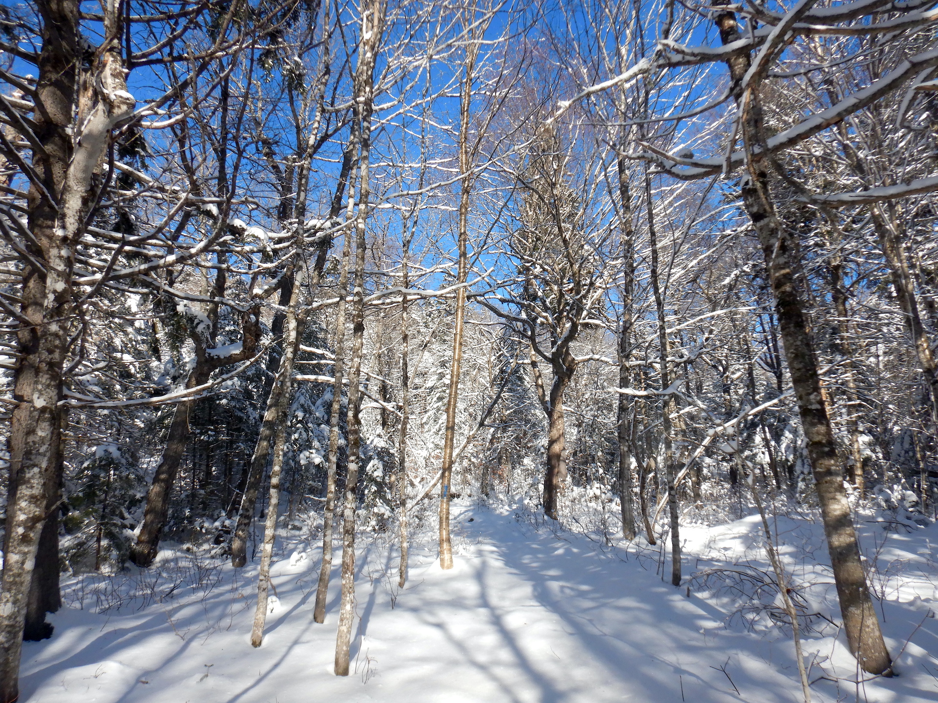
But this post isn’t about falling snow. Rather, it’s about a story written in the snow. Instead of looking at the wintertime forest as lonesome and empty, snow allows me to better understand how the landscape is a fully inhabited place.
Last Monday, I highlighted the travels of a fisher during More to Explore, a bi-weekly highlight show on explore.org cohosted by Brian Byrd and me.
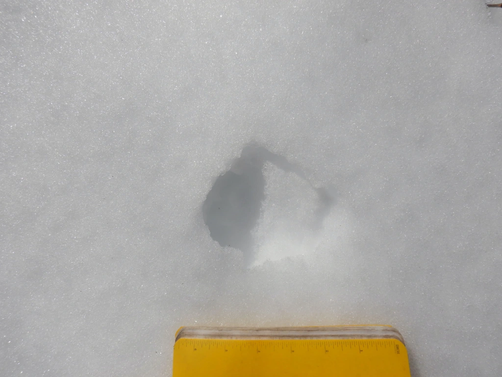
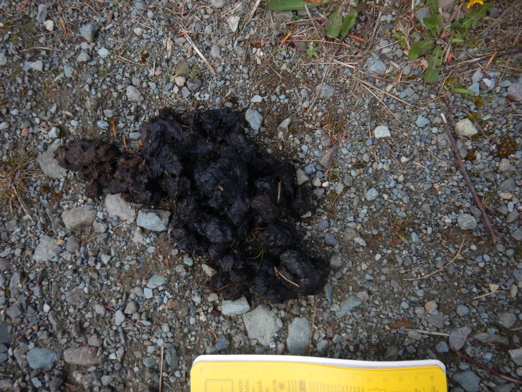
In the interest of brevity for the show, I skipped some details of the fisher’s trail. Tracking is an art that I’m still learning and I argue that I’m a slow study, but a few clues revealed I was looking at a fisher’s trail rather than a fox, coyote, marten, or lynx, all of whom inhabit the area.
Claw marks registered in most of the prints that I examined carefully, effectively ruling out felines since their claws are retractable and don’t register reliably in tracks.
The clearest tracks had five toes—an important clue that rules out the canines such as foxes and coyotes. Porcupines, bears, skunks, hares, and rodents can make five-toed tracks too, but they have other features that make them distinctive.*
The tracks’ size were too large for other members of the weasel family who live here such as short- and long-tailed weasels, mink, and marten. I could rule out river otters too since there was no evidence that the animal slid across the snow (something otters routinely do) or sought liquid water. The trackway crossed a beaver-created swamp but the tracks did not lead to water as an otter would have.
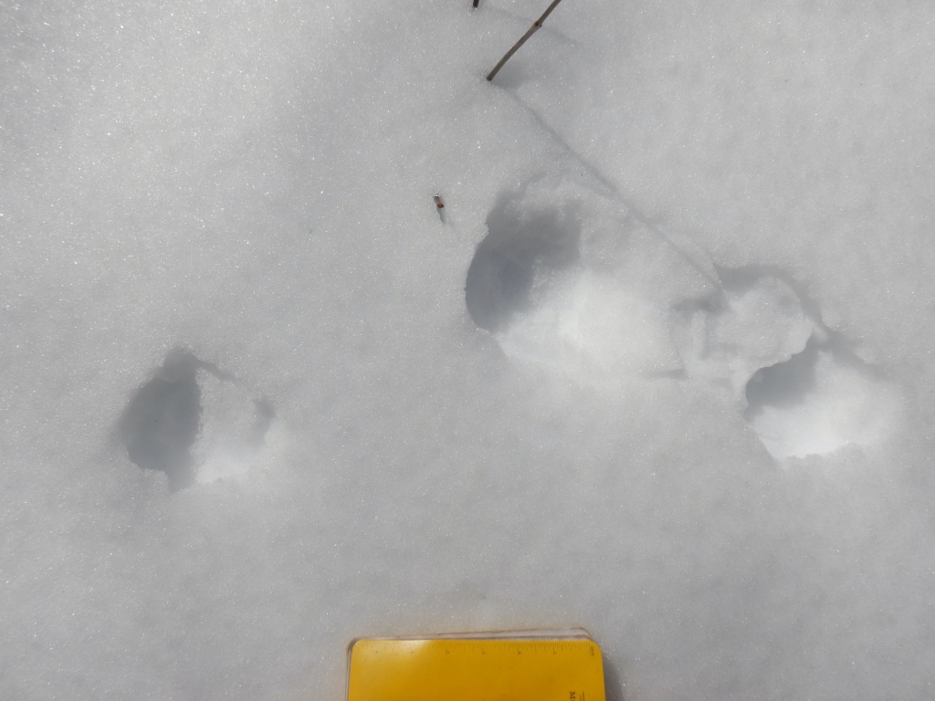
The animal’s gait was a mostly loping in a 3 x 4 pattern, which is a common way for fishers to travel. The 3 x 4 lope is a method of travel where a fisher places a front and rear foot from one side of the body in the same place, while the feet on the other side do not overlap. This gives the impression of only three tracks instead of four. Fishers walk, lope in a 2 x 2 pattern, and gallop too, but in my experience they’ll use a 3 x 4 pattern much more often in firm snow than American martens.
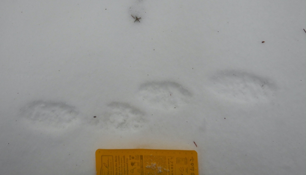
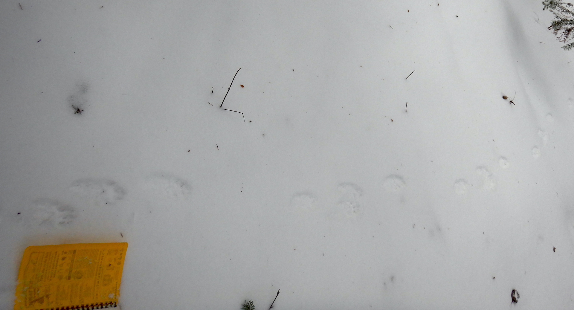
A clear set of fisher prints. Her five toes are perhaps easiest to see in the second track from left. Also note that the fisher created four prints here so she slightly deviated from her typical 3 x 4 lope.A trackway from the fisher. She was moving with a 3 x 4 lope across firm snow. My notebook is about 17 cm wide for scale.
Several other mammals were active that day as well. Snowshoe hares, red fox, red squirrels, mice, and voles all left tracks or scat to reveal their presence. I was only lucky enough to be chastised by a couple of squirrels and didn’t see any other mammals for the majority of the day but walking slowly and quietly gives one the opportunity to be surprised. In a moment of quiet contemplation, the kind you experience while gazing through trees pondering your next move, a glimmer of movement appeared in the corner of my eye. I turned my head to find a weasel bounding through the snow. I didn’t dare reach for my camera knowing I’d spook it into hiding, although I remember clearly my confusion upon seeing it.
A long-tailed weasel changes its fur color from summer brown to winter white and back again with the seasons. In winter, they are nearly pure white except for the tip of their tail, which is black—a feature that seems to misdirect attacking predators away from the head. This weasel, however, appeared to have a dark tail and head.
My brain needed to register a few more bounds by the weasel to clear the confusion. it wasn’t oddly colored. The weasel was carrying a vole or mouse in his mouth. As he disappeared in a thicket, I was offered a special opportunity to examine its prints for clues about that may help me better understand how small weasels move in snow when they are burdened by the weight of their prey.
Long-tailed weasels and the smaller short-tailed weasel (ermine) travel most often in snow by using a 2 x 2 lope. When you see them traveling in this way, it looks almost like a long hop, with the front feet hitting the ground first. The front feet quickly lift into the air while the hind feet land in the same place. The weasel I watched used this method and he seemed to carry his rodent cargo with ease—an impressive display of relative strength. His prey, though, left an important clue. Each of the weasel’s bounds were accompanied by a slash in the snow, which must have been created by part of the dead rodent (a foot? a tail?) dragging in the snow with each leap of the weasel.
A long-tailed weasel’s prints are underscored by a slash in the snow created by the rodent prey it carried.Two sets of prints from a long-tailed weasel. Note the repeating slash next to each track. The weasel traveled from right to left.
As I discussed in the video segment above, the life of a fisher would be far more mysterious without the record it leaves in snow. I would have no real clue how much fishers leave scent marks or climb trees without reading their trackways. Likewise, if I’d not been in the right place at the right time or been looking in a different direction I would have missed the weasel and its meal completely. Had I stumbled upon its trail with the strange, repeating mark next to each print I’m not sure I’d reason it was from the weasel’s prey. But now, I’ll be looking for other examples like it.
I hope you have the opportunity to utilize snow to learn more about your neighbors. When the snow pack melts in spring, I welcome the change although I must admit that forest seems a bit lonelier when I don’t know who has been visiting.
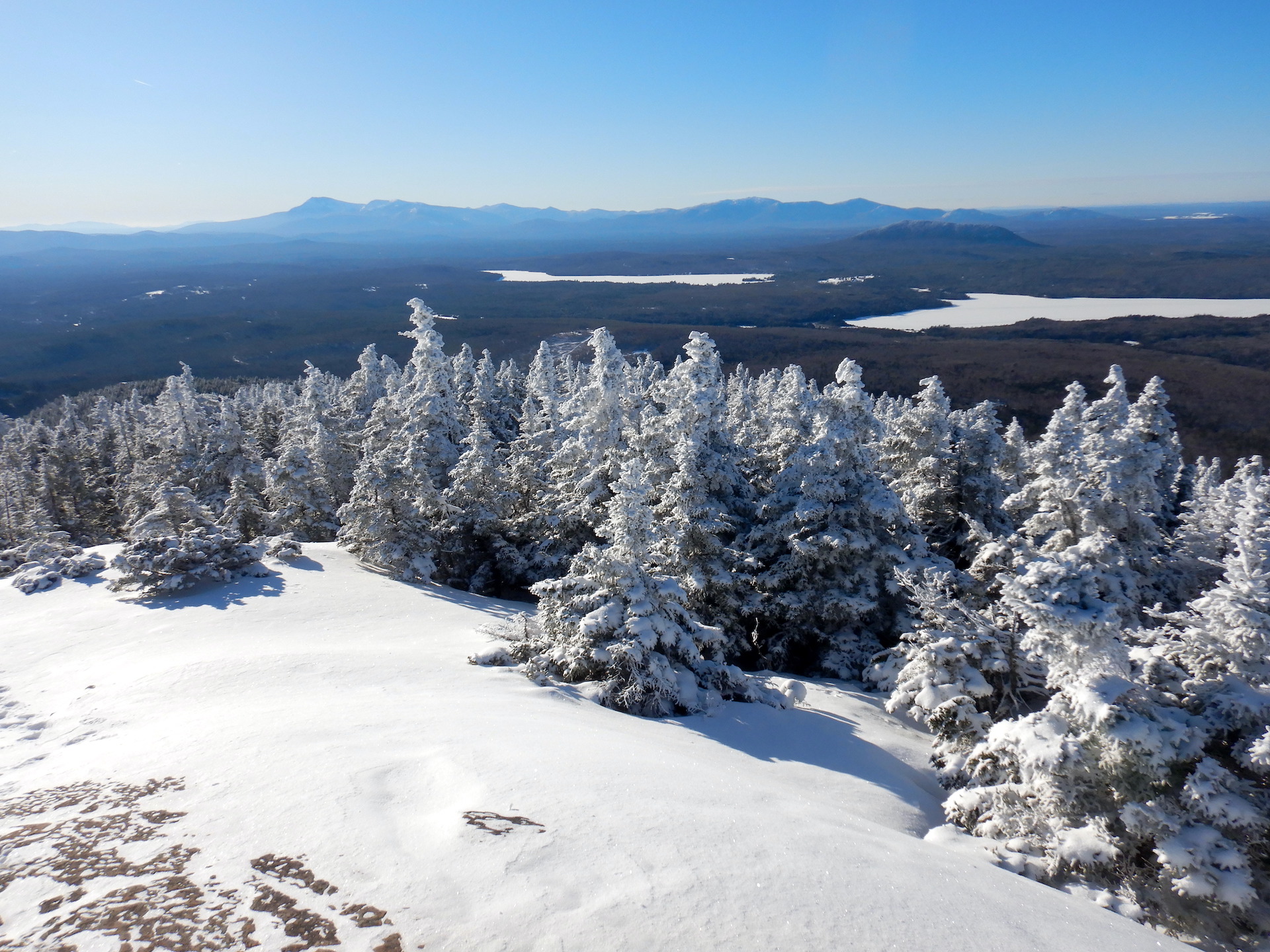
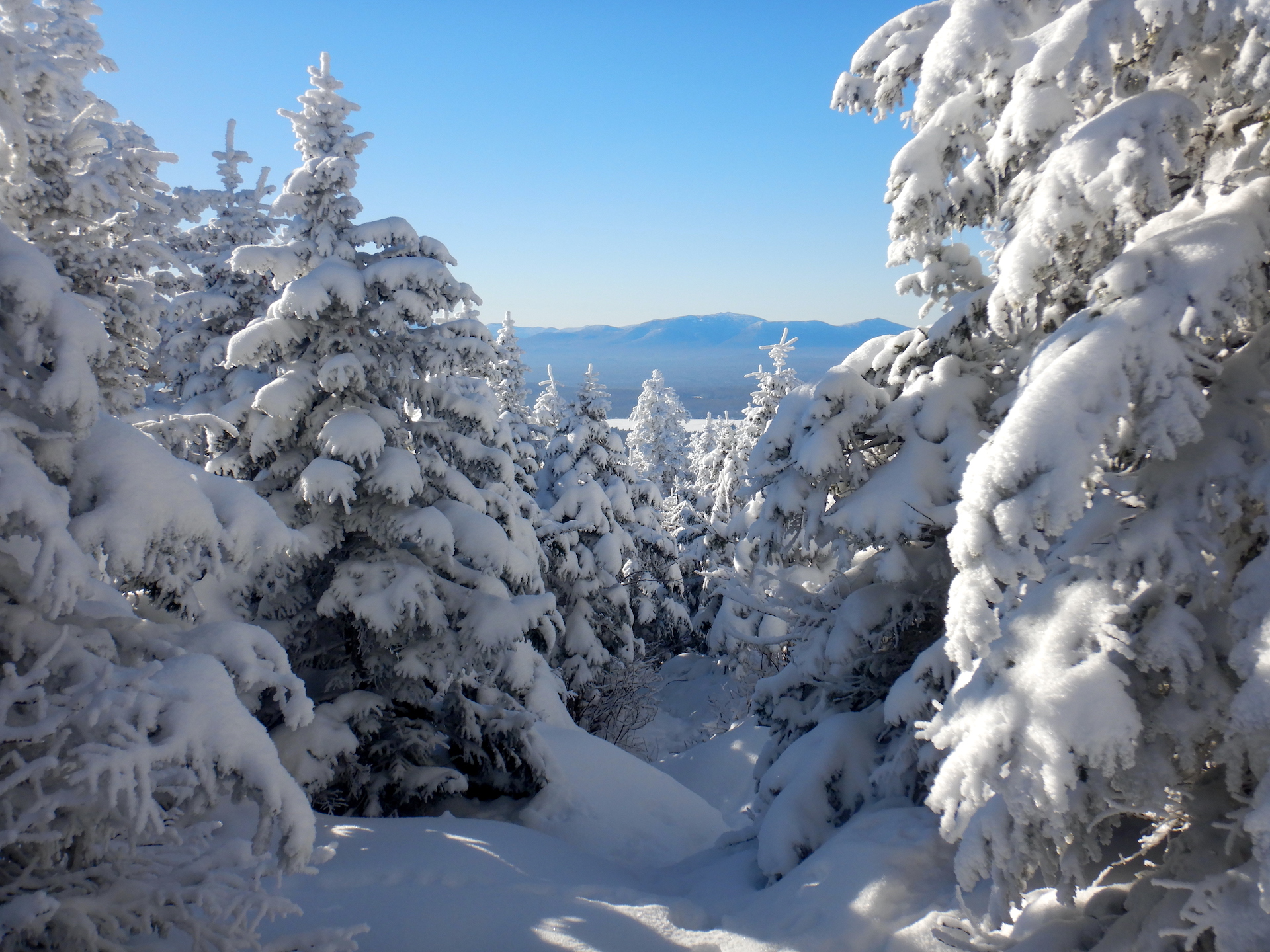
Truly knowing a place might be a capacity only of the omniscient or for earthly beings, perhaps, something gained through multi-generational experience. Lacking omniscience, living in an area far from where I was raised, and having lived in my home only for a few years, I’m forced to make do as best I can. I’ll never know a place in its totality, but I’ve come to realize that I can get closer if I experience it in every season, which is how I found myself trekking to the top of Mount Chase, Maine during every month of the year.
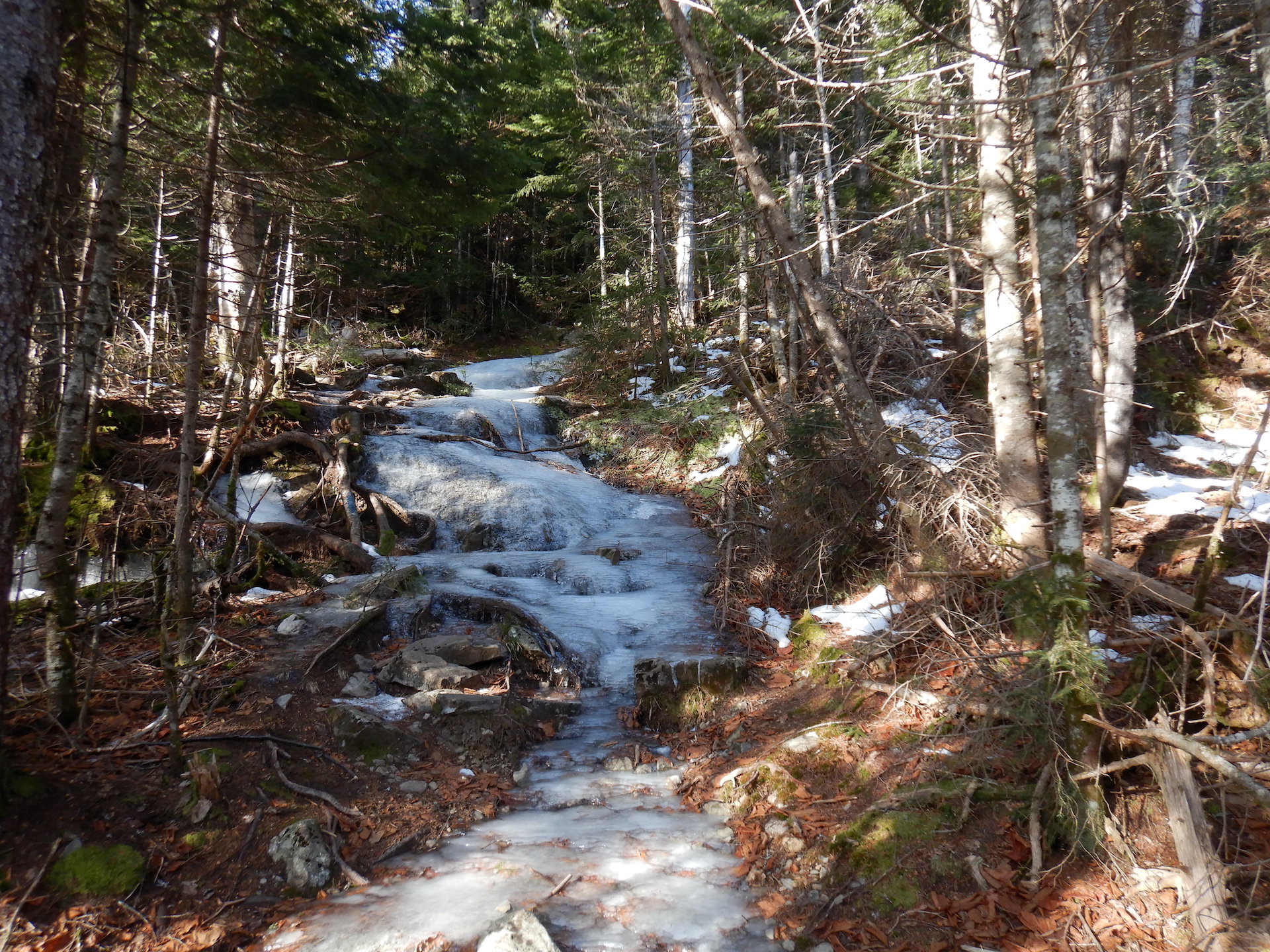
December 11, 2022 The first trip in the journey and the most treacherous. Snow has yet to establish itself for the winter and ice covers many sections of trail. The summit is frosty. The hike down is much slower than the hike up.
Ice covers the Mount Chase Trail on Dec. 11, 2022.Looking west from the Mount Chase summit toward Upper Shin Pond, Sugarloaf Mountain, and Traveler Mountain.
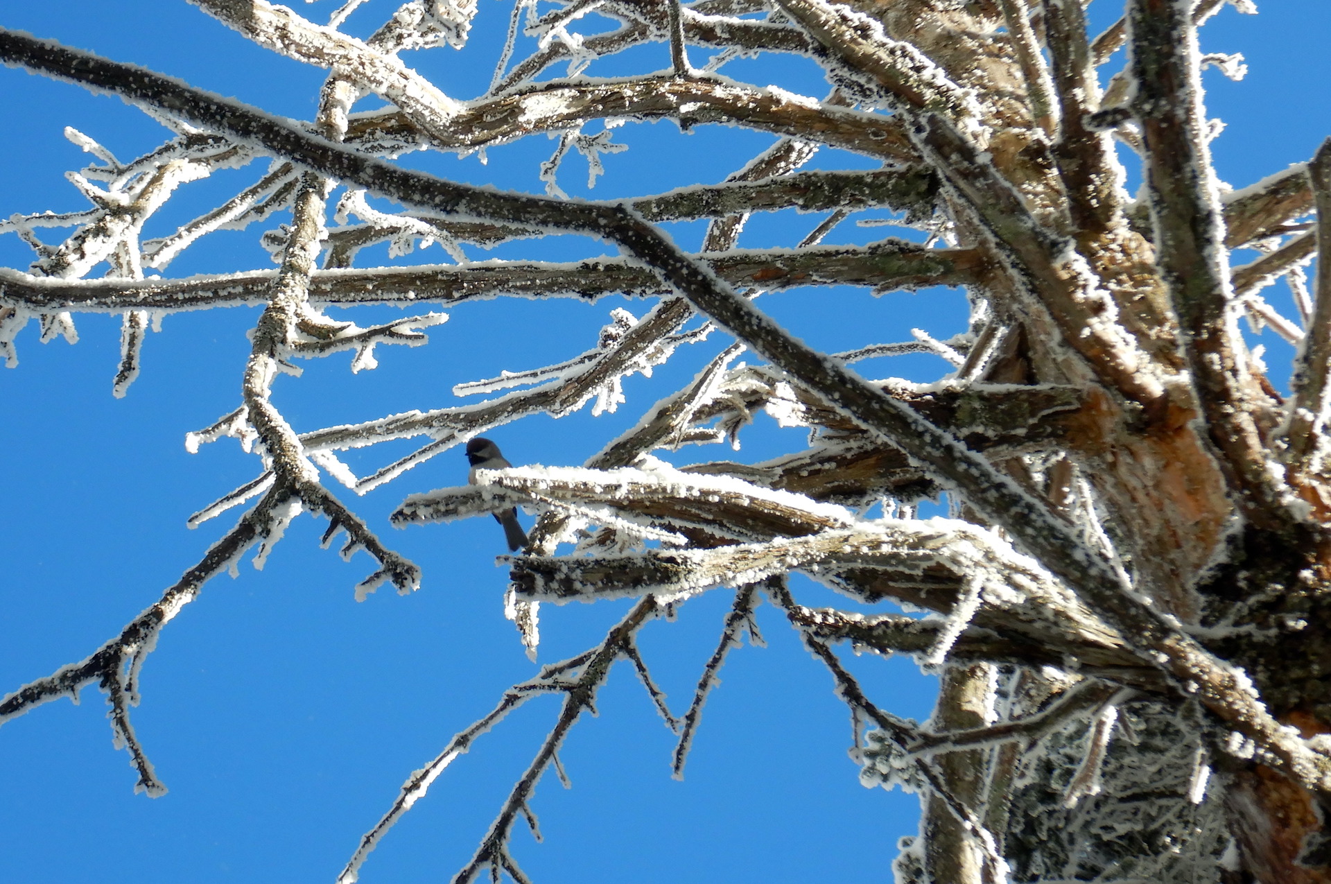
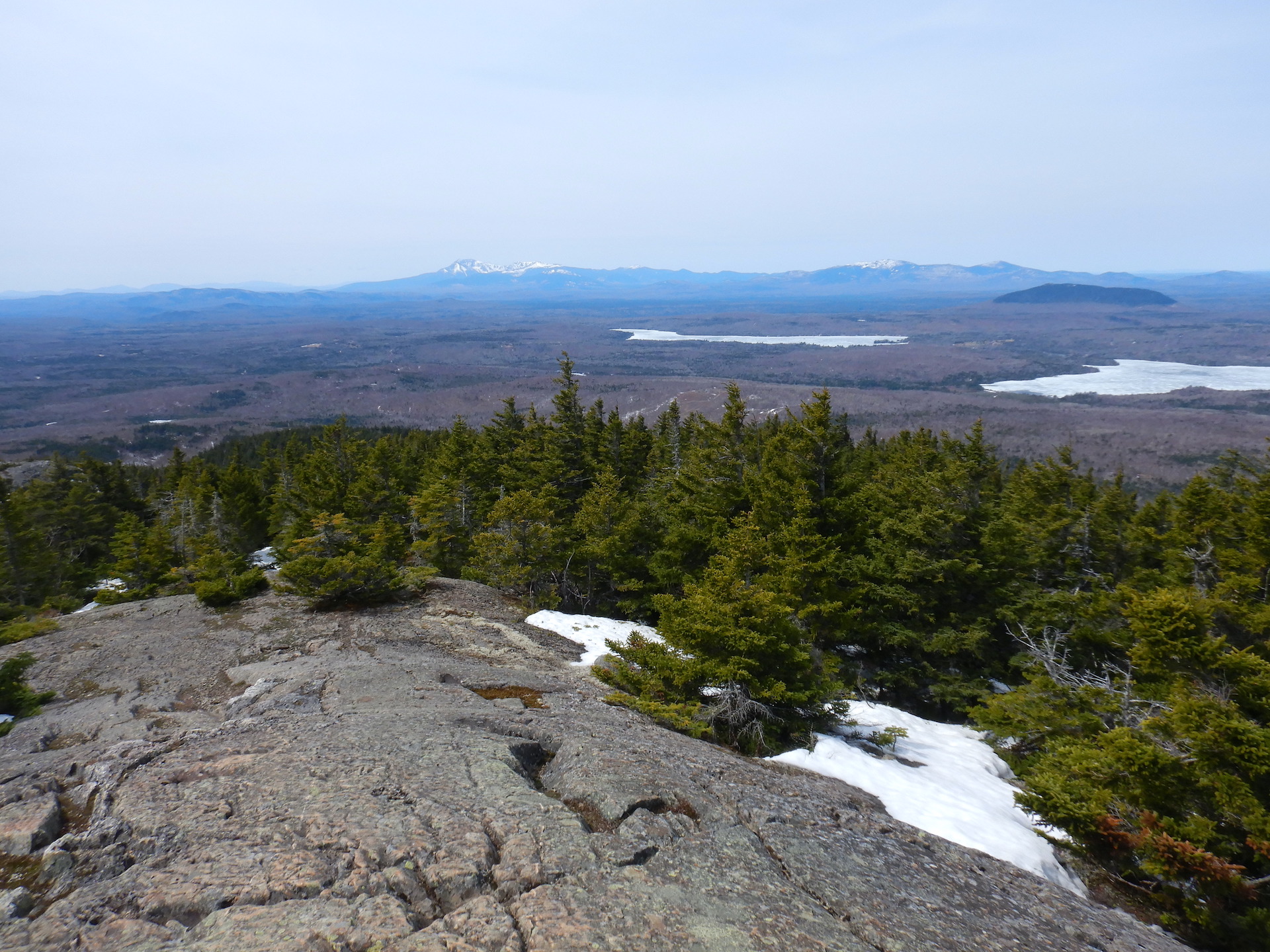
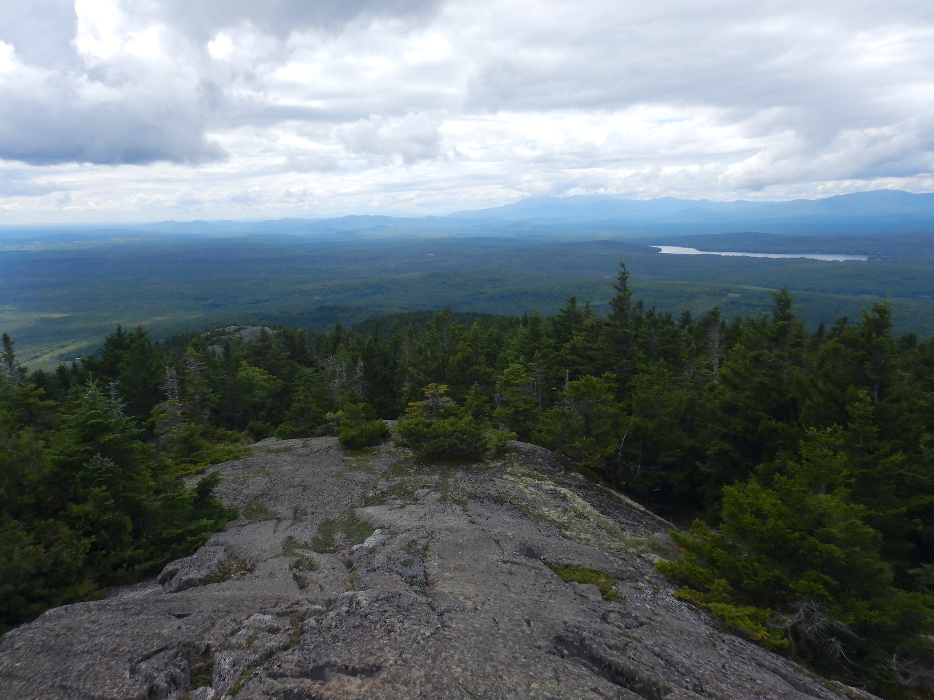
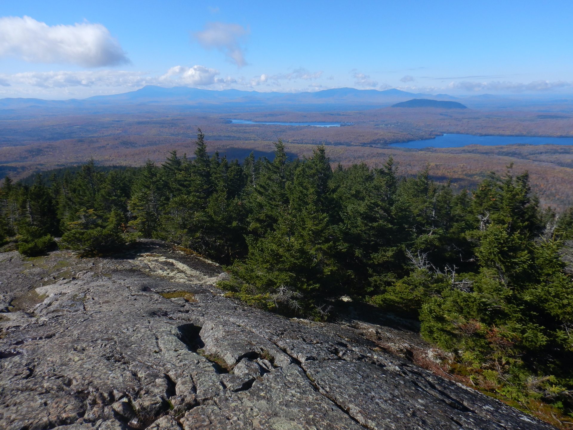
January 8, 2023 With snow now covering the ice, the trip is far easier than last month and the snow is not yet thick enough that I have to ski to the trailhead. My trusty fat tire bike, Large Marge, gets me there. At the summit, visibility is exceptional and perhaps only limited on this day by the curvature of the Earth. On the way down, I hear a raspy-sounding chickadee. A boreal? Yes. I see it fluttering from branch to branch in the spruce-fir forest maybe 200 – 300 feet in elevation below the summit.
The view to the west-southwest from the Mount Chase summit on Jan. 8, 2023. The mountains of Baxter State Park including Katahdin form the horizon.A boreal chickadee perches in a dead spruce.
February 12 Peak winter. Minus 60˚ F wind chills during the week prior and low air temps approaching -30˚ F at home. I know arctic peoples cope with those temperatures routinely, but I’m too poorly prepared to survive those conditions. Thankfully, this day is warmer, so much so that snow fleas are active on the snow surface. I ski as far as I can up the trail. Eventually, I abandon my skis and walk the rest of the way when the trail steepness beyond my comfort level. The trail is also too narrow to ski down safely and I don’t own the the right style of skis or the skills to do that anyway. On the way up, though, I miss their floatation. The snow pack on the upper mountain must be at least 36 inches. I post-hole to my waist on two occasions.
The destination: Mount Chase on Feb. 12, 2023.The view looking south from the Mount Chase summit on Feb. 12, 2023.
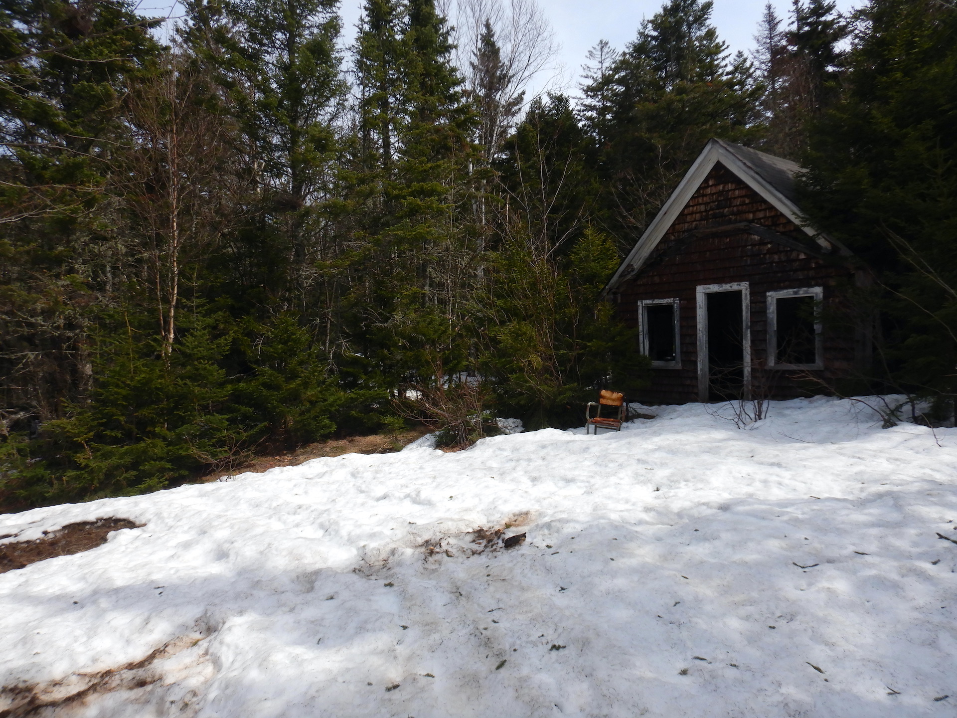
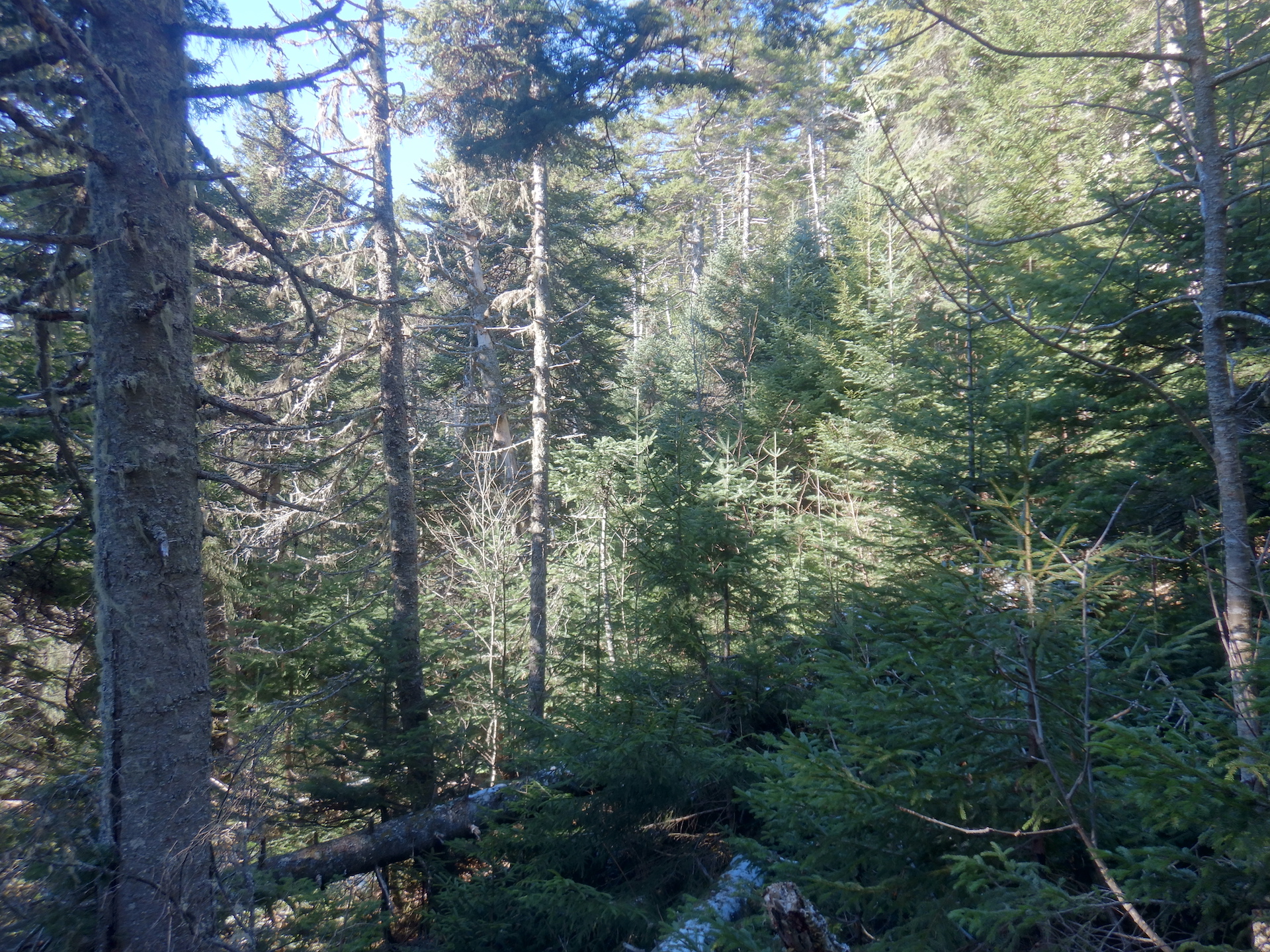
March 11 The snow seems deeper than February, but maybe this will be the last deep snow trip of the year? Along an alternative route I like to take to the main trail, I find a set of lynx prints in the snow. Farther up the mountain I ditch my skis again at a point above the abandoned fire warden’s cabin where the slope gets too steep. A few snowmobiles have made the trip, though, and I continue with relative ease in their trackways.
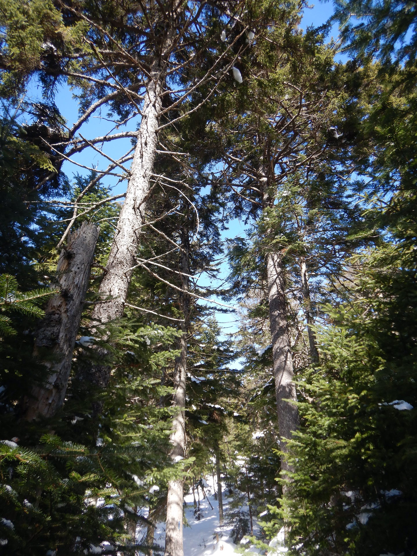
A single lynx track. The feline was traveling from right to left.Although these lynx tracks aren’t well defined, the size and shape are distinctive. I find one set of these tracks per winter on average. Lynx are rare in Maine and have large territories.The coniferous forest on the upper slopes of Mount Chase.
April 22 A difficult trip to the top and back (the hardest of them all, in hindsight). Mud season has fully enveloped the region. The dirt roads that approach the trailhead are slop. Large Marge gets me to the trailhead but not without extra effort from my legs. The trail remains almost wholly snow-covered above the abandoned fire warden’s cabin and the remaining snow is soft. Still, I’m thankful winter’s dormancy is broken. Near the trailhead, I hear wood frogs looking for love in a nearby a vernal pool. The calls of juncos, robins, and sapsuckers—birds that do not overwinter here—fill the deciduous forest nearby.
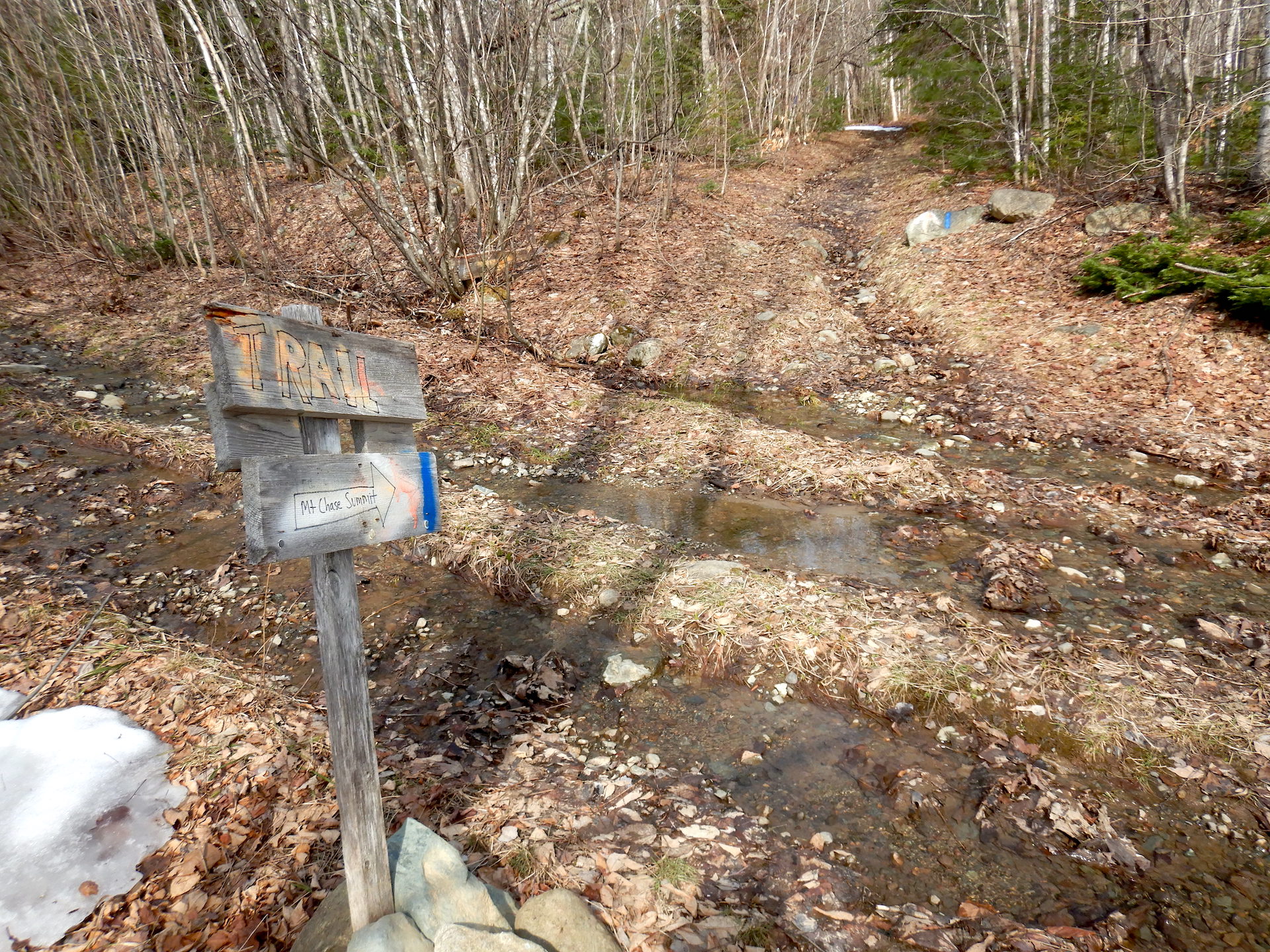
The official Mount Chase trailhead.The abandoned fire warden’s cabin on Mount Chase.Looking west-southwest toward Katahdin and Baxter State Park from the Mount Chase summit on April 22, 2023.
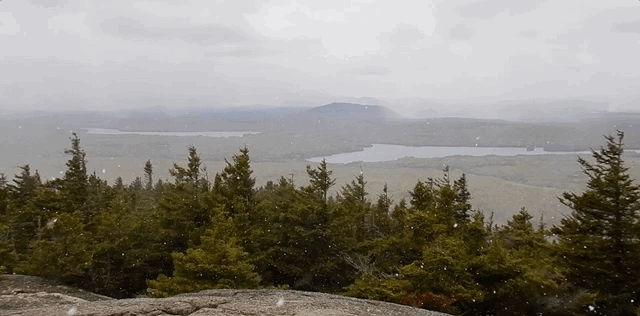
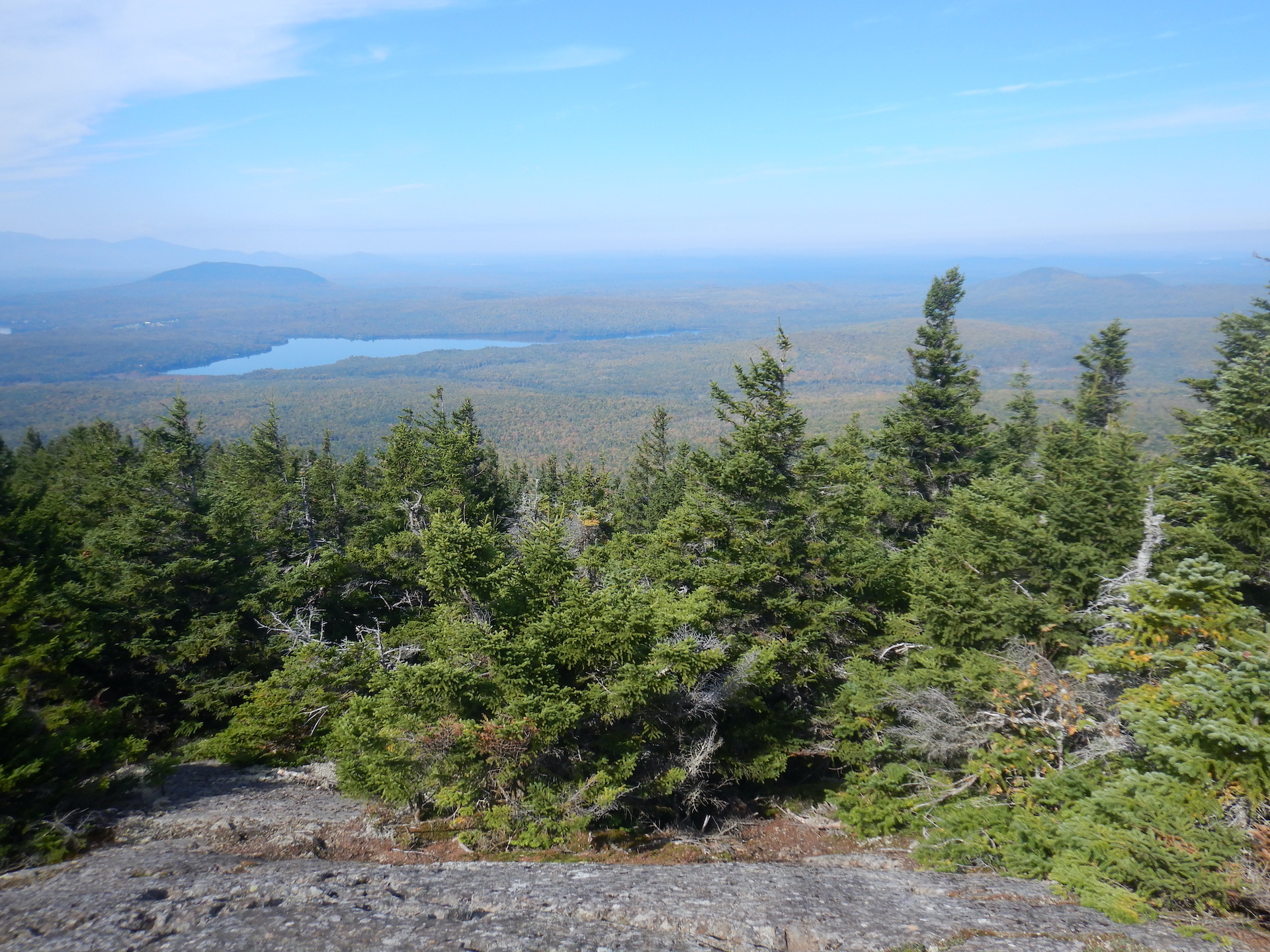
May 17 I thought I’d be done with snow on the mountain by now. I was wrong. It falls on the way up and on the summit. Some small patches linger in the shadiest areas among the spruce and fir. Bud break might be advancing fast at lower elevations, but the plant phenology seems at least a week delayed on the mountain’s mid elevations and maybe two weeks behind in the summit area.
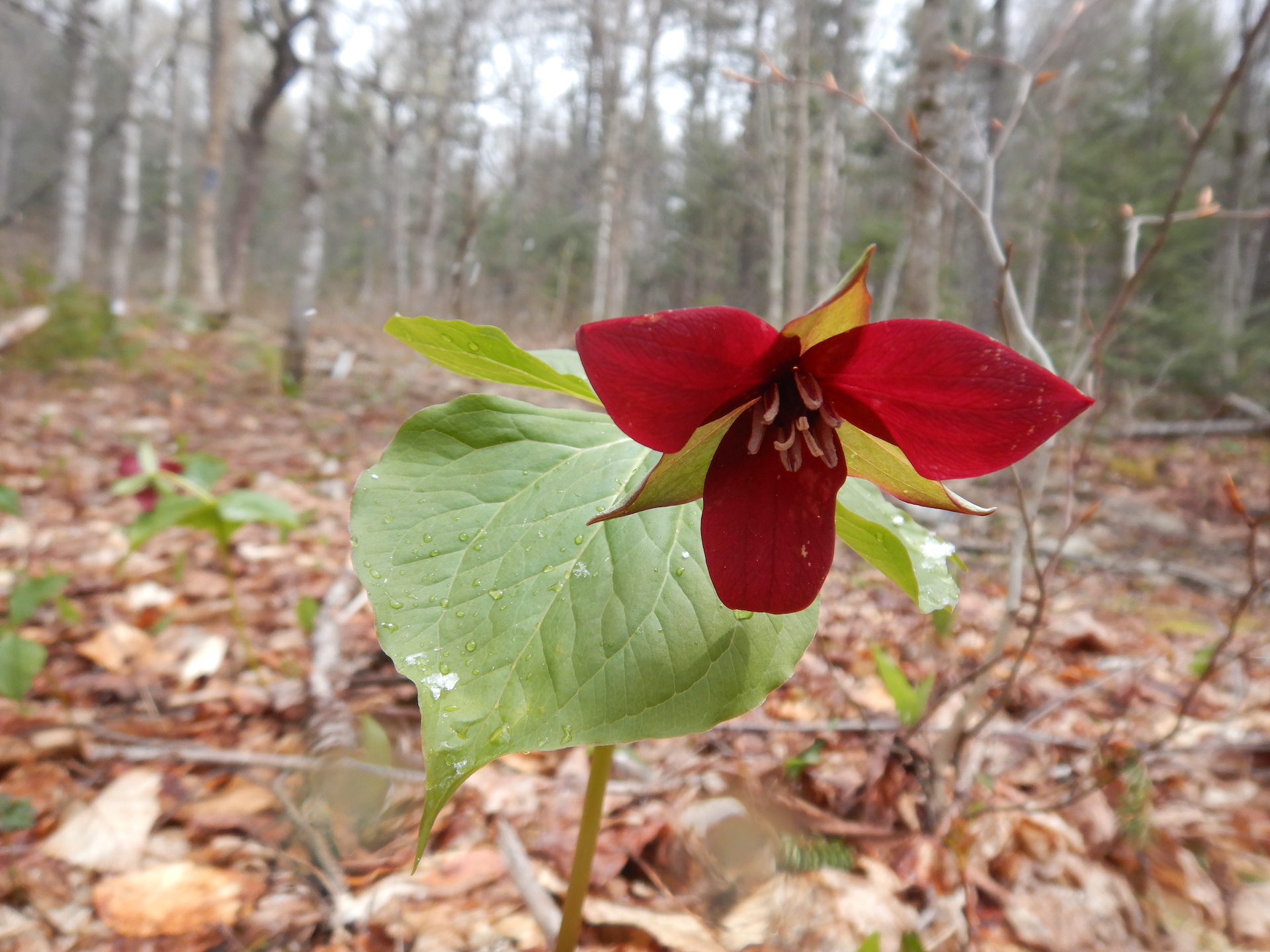
Trillium erectum on the lower slopes of Mount Chase.
June 19 A busy day on the trail with a whopping three cars at the trailhead! Large Marge, as usual, doesn’t have any other bicycles to keep her company. The forest has come to life. I note more than 20 plant species blooming. Biting insects are surprisingly few in contrast to home where the abundance of mosquitoes and black flies force me to don long sleeves, long pants, and a headnet almost anytime I intend to spend more than a few minutes outside. In the spruce-fir forest, I enjoy listening to the songs of blackpoll warbler. Sadly, they are categorized as a threatened species in the state.
Late spring on the Mount Chase Trail.This is the song of a blackpoll warbler recorded in the spruce-fir forest of Mount Chase. The song is a rapid series of high-pitched notes near the beginning of the track. The audio also captures part of the songs of Swainson’s thrush and winter wren.
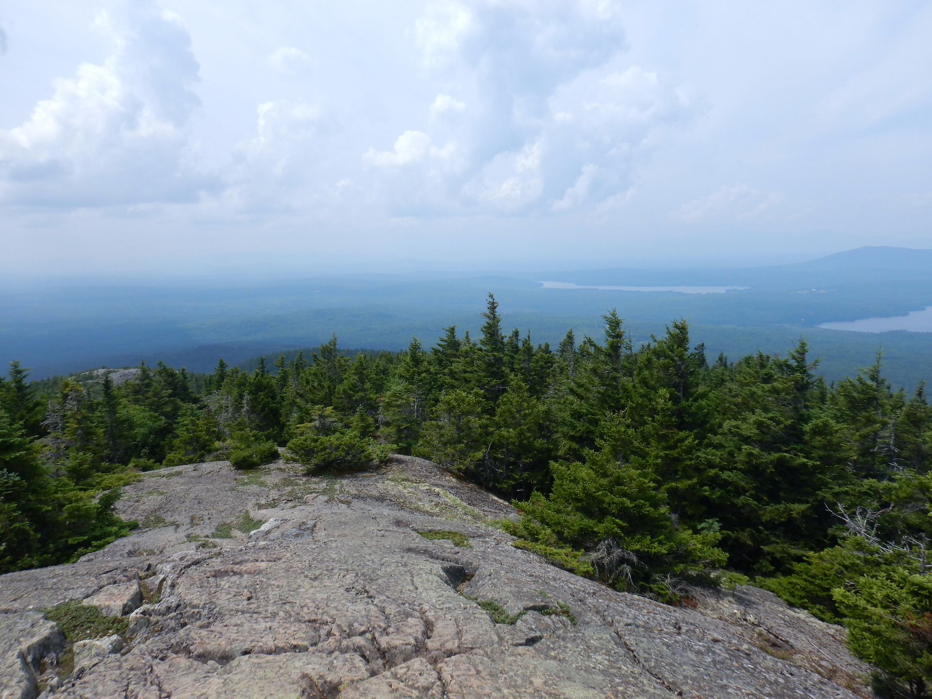
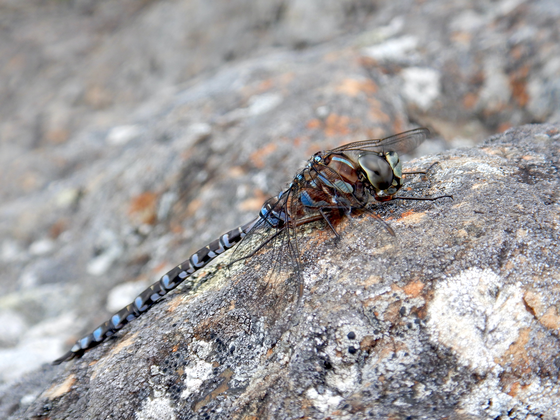
July 21 The air feels and looks heavy due to high humidity and hazy, smoke-filled skies. This isn’t the first day of the summer with these conditions, and the past two summers had days like this too. Is the presence of smoke becoming the new normal for summertime Maine? I concentrate on observing the trees, which are in “peak green,” a phase in summer when the foliage has reached its max yet still retains some of the freshness of spring. Fledgling birds are the latest addition to the animal community. Golden-crowned kinglets and red-eyed vireos feed noisy babies. On the summit, hundreds of dragonflies zip between the stunted trees.
Peak green on Mount Chase trail. July 21, 2023.Looking west-southwest through smoky haze toward Katahdin and Baxter State Park from the Mount Chase summit on July 21, 2023.A darner dragonfly of genus Aeshna rests on at the summit of Mount Chase. If you know what species it is, please identify it on iNaturalist.
August 20 A quiet hike now that songbird nesting season is done. Only white-crowned sparrows sing in the summit area. The summer foliage has reached “tired green.” The work of photosynthesis as well as insect attacks have rendered the previously vibrant leaves a darker, less vibrant hue. I experienced a stressful week. Yet, I’m fortunate to have an escape for some brief solace.
A section of old growth forest on upper Mount Chase.Looking west-southwest toward Katahdin and Baxter State Park from the Mount Chase summit on August 20, 2023.
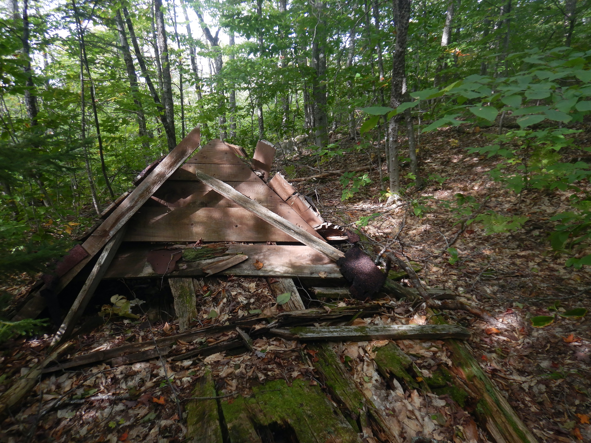
September 24 I discover (for myself) the remnants of a long abandoned cabin maybe 20 yards off the trail. It’s collapsed to its foundation. Still, I’m surprised by its presence. I walked by it many times previously without seeing it. The forest tends to make things disappear. Hazy conditions have returned to the area. A thick band of wildfire smoke clouds the north horizon and the mountains of Baxter State Park are mostly obscured. A few red-tailed hawks ride the thermals on the mountainside on their migration south. A raven family doesn’t tolerate their presence. They move to chase one of the soaring hawks. We’re approaching peak fall colors, although the colors are quite muted compared to normal.
The forest and weather will soon consume this collapsed cabin.The Mount Chase Trail on Sept. 24, 2023.Looking west-northwest from the Mount Chase summit on Sept. 24, 2023.
October 18 The forest trends brown. A solid layer of newly fallen leaves cloaks the forest floor. I somehow sleepwalk most of the way to the summit, a habit I’ve been trying to break for years with greater mindfulness. I find myself stopping to focus on my breath and immediate surroundings. Something distracted me, probably precipitated by a media culture that profits from distraction and rage-inducing social networks. It is possible to walk through a forest and not see it at all.
The Mount Chase Trail on October 18, 2023.Looking west-southwest toward Katahdin and Baxter State Park from the Mount Chase summit on October 18, 2023.
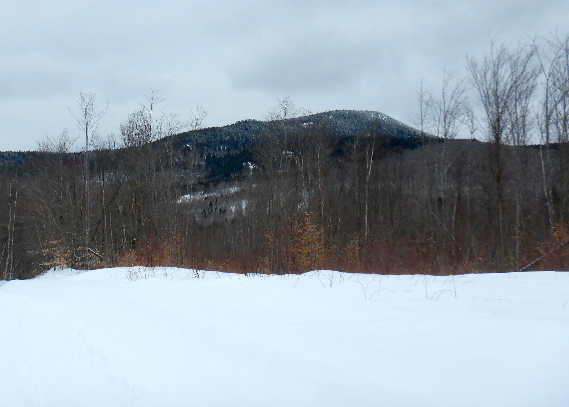
November 16 I begin at an alternative trailhead that I’ve used a few times this year. The route isn’t maintained. It’s nothing more than a decades-old skidder trail, but it is a quicker and more secluded course than the main trailhead. The year has been wetter than average, so water has consistently flowed over parts of the trail. Mid fall brought a prolonged stretch of dry weather though, and the trail is drier than it has been over the entire year. Winter will soon be here. The canopy is bare. Patchy snow sits in the shady areas of the mountain’s spruce-fir forest.
The old growth forest on upper Mount Chase on November 16, 2023.Looking west-southwest toward Katahdin and Baxter State Park from the Mount Chase summit on November 16, 2023.
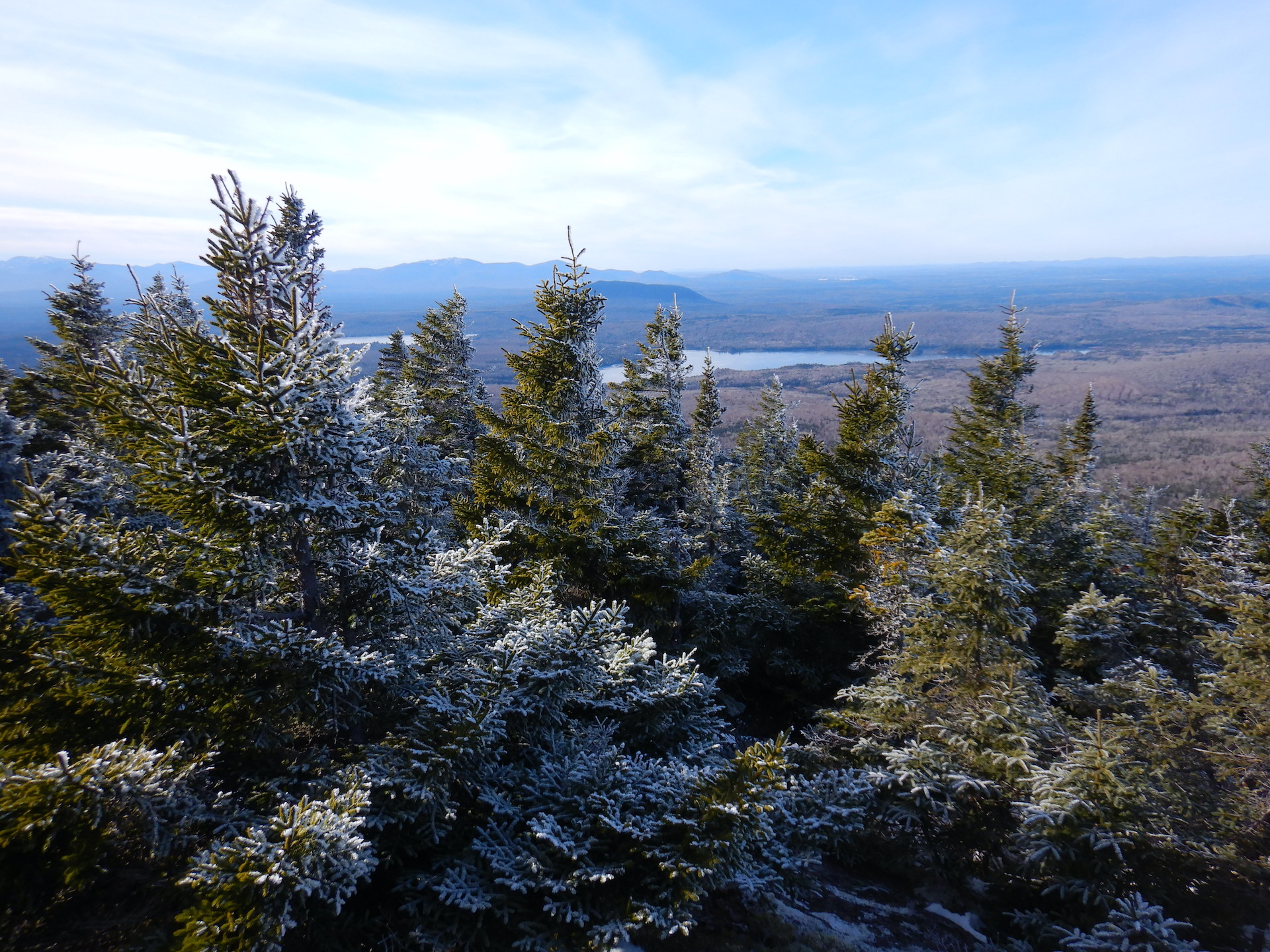
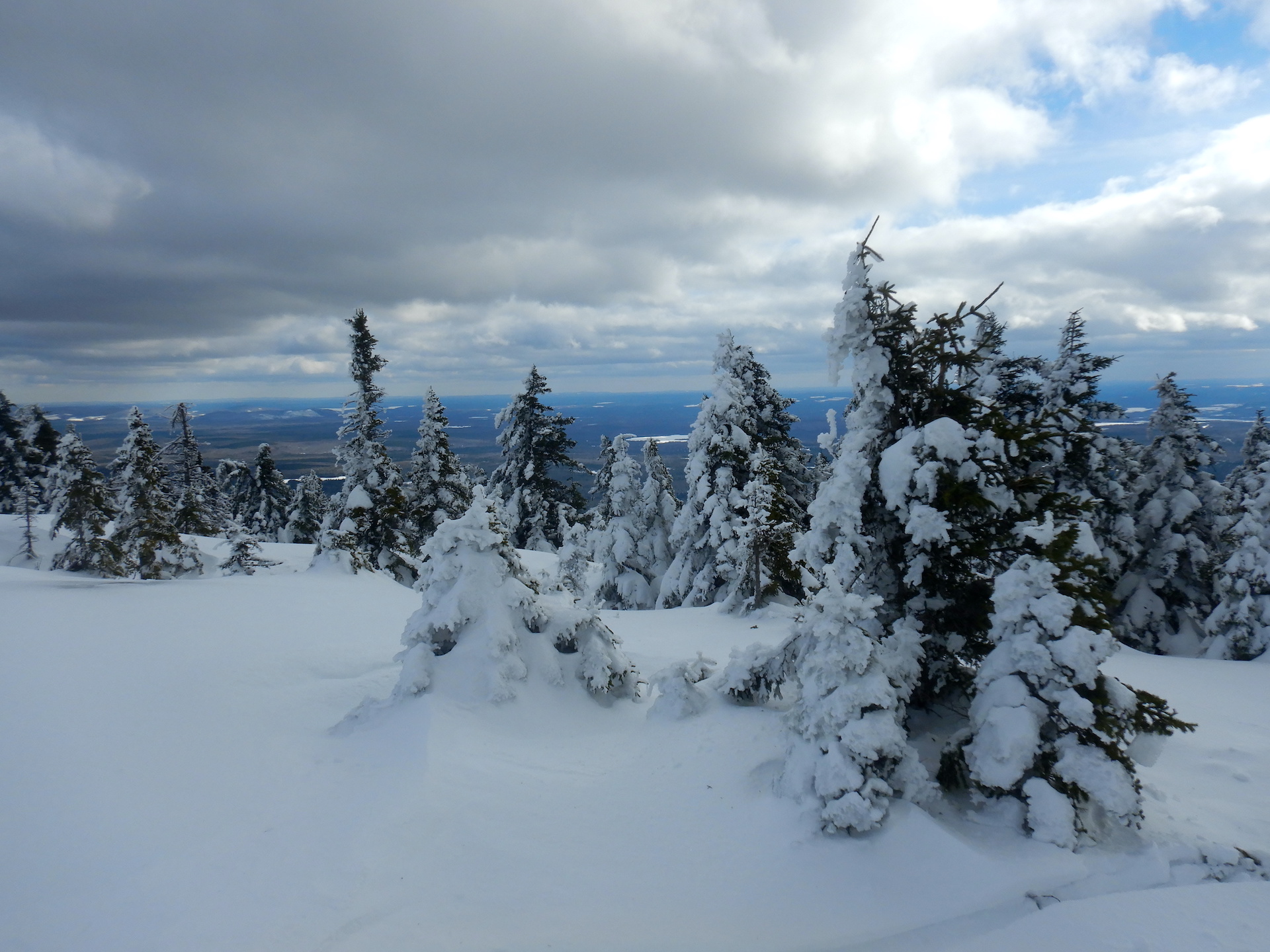
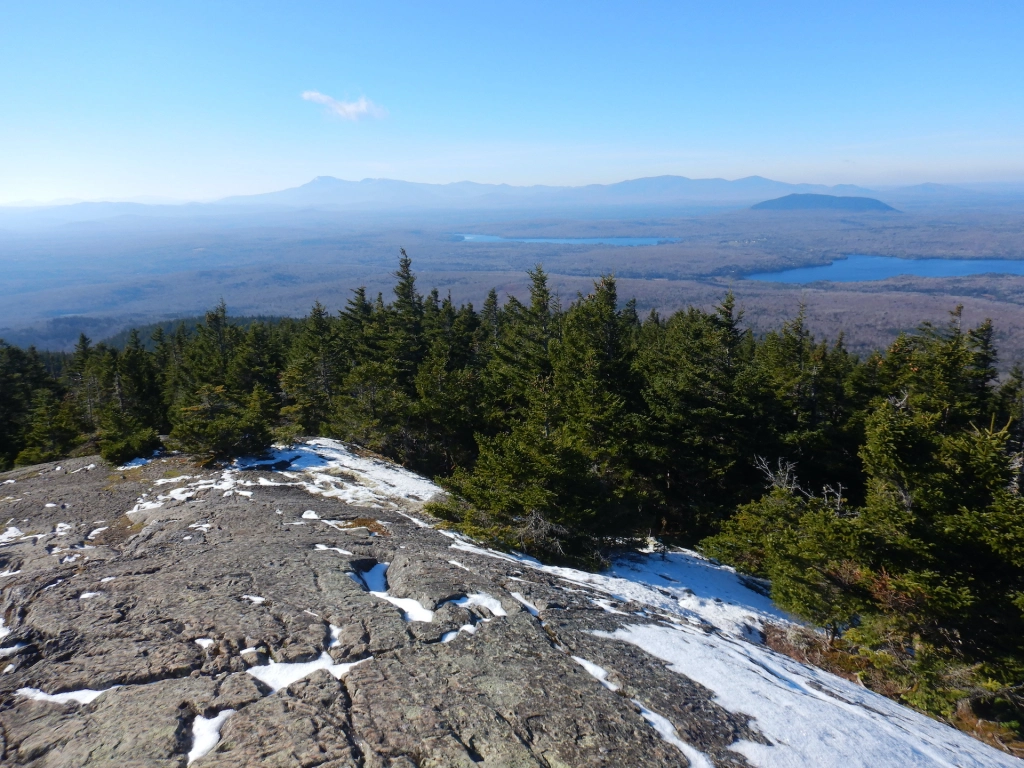
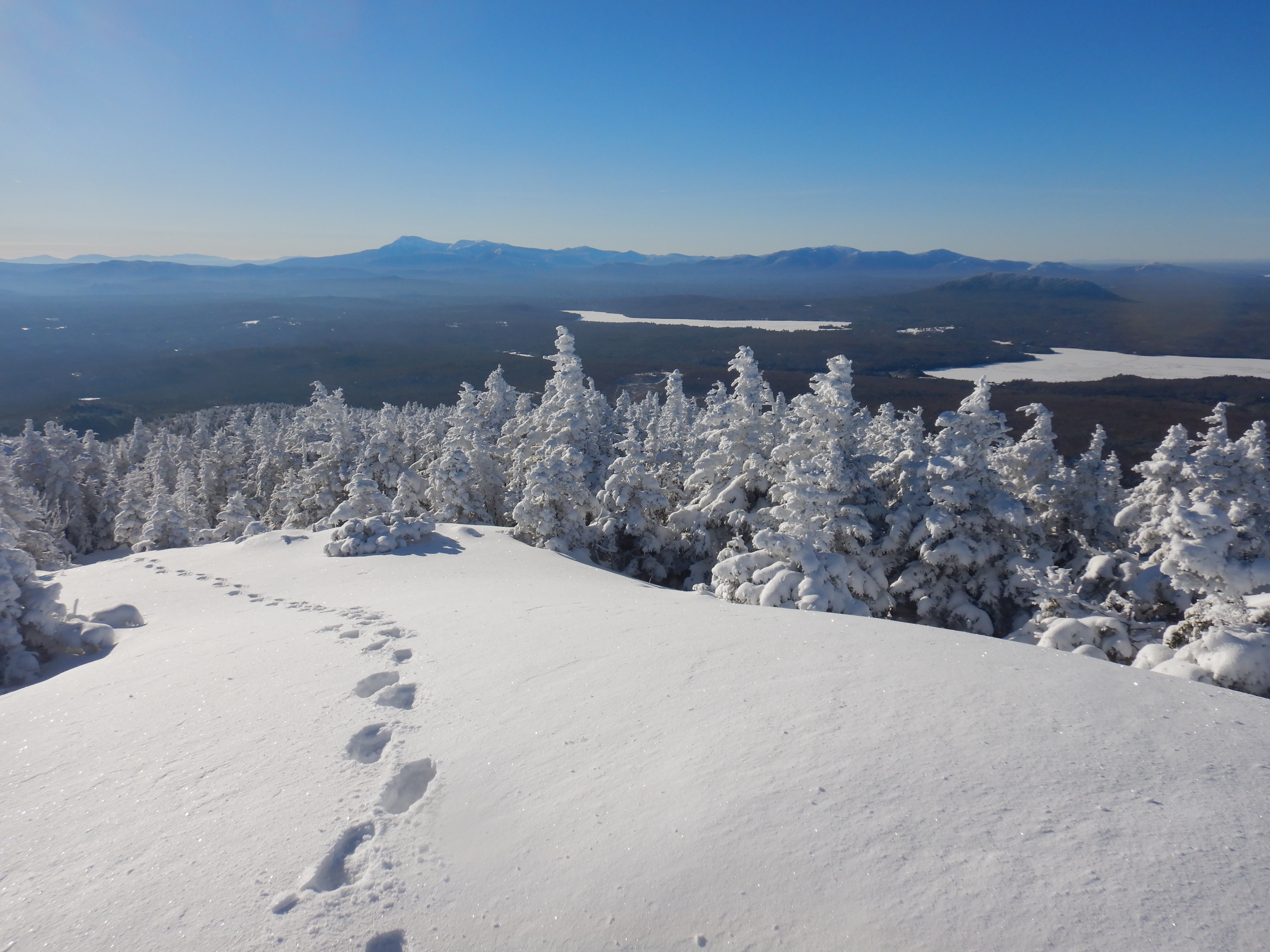
December 8, 2023 Winter is a time of dormancy for many life forms, although it brings vibrancy in other ways. None of the previous trips were as beautiful or as quiet. Several inches of snow coat the ground at low elevations and about 12 inches linger higher on the mountain. No human footprints are discernible on the trail. Snow and hoarfrost cover the conifers like cake icing. The landscape appears clean in a way that I don’t find in spring, summer, and fall.
Large MargeThe Mount Chase Trail on December 8, 2023.The final approach to the Mount Chase summit on December 8, 2023.Looking down the Mount Chase Trail near the summit on December 8, 2023.Looking west-southwest toward Katahdin and Baxter State Park from the Mount Chase summit on December 8, 2023.
Time spent in the forest is never wasted and every moment offers the potential to discover new perspectives. I’m no closer to profound insights after thirteen trips to the summit of Mount Chase, although I’ve walked away with a greater appreciation for the mountain’s rhythms. The experience is both the same and vastly different every time.
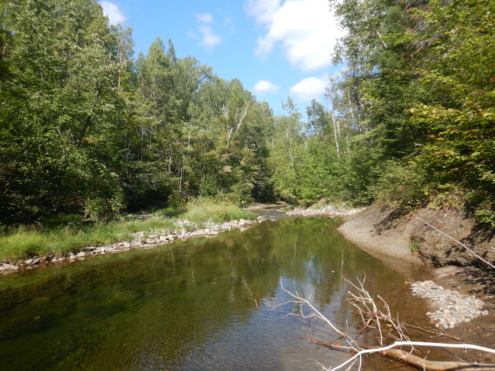
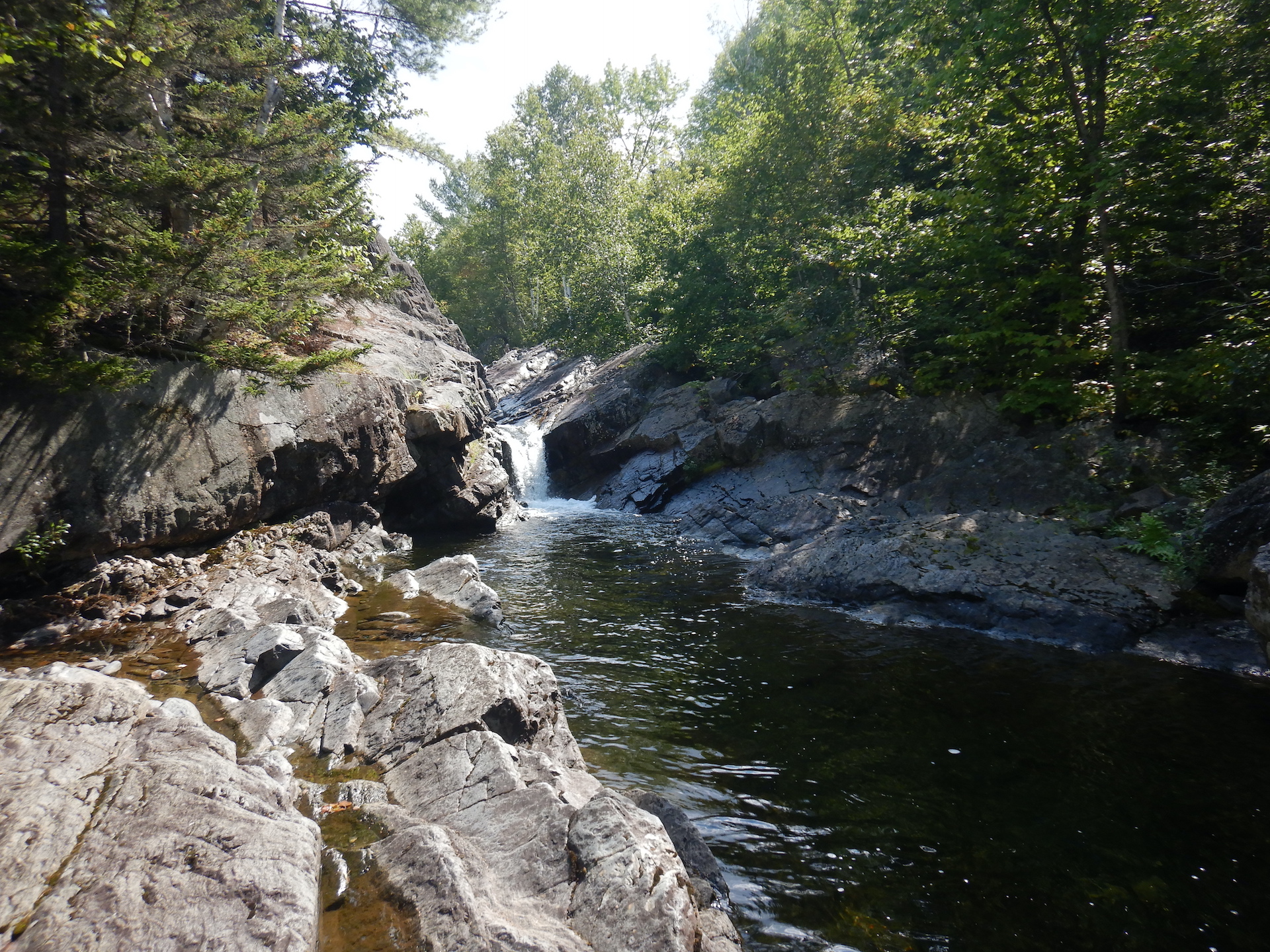
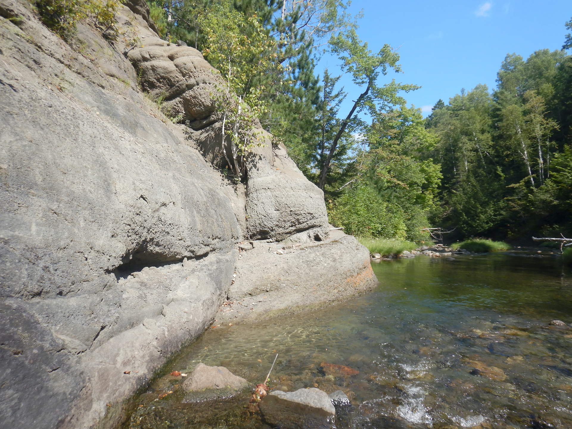
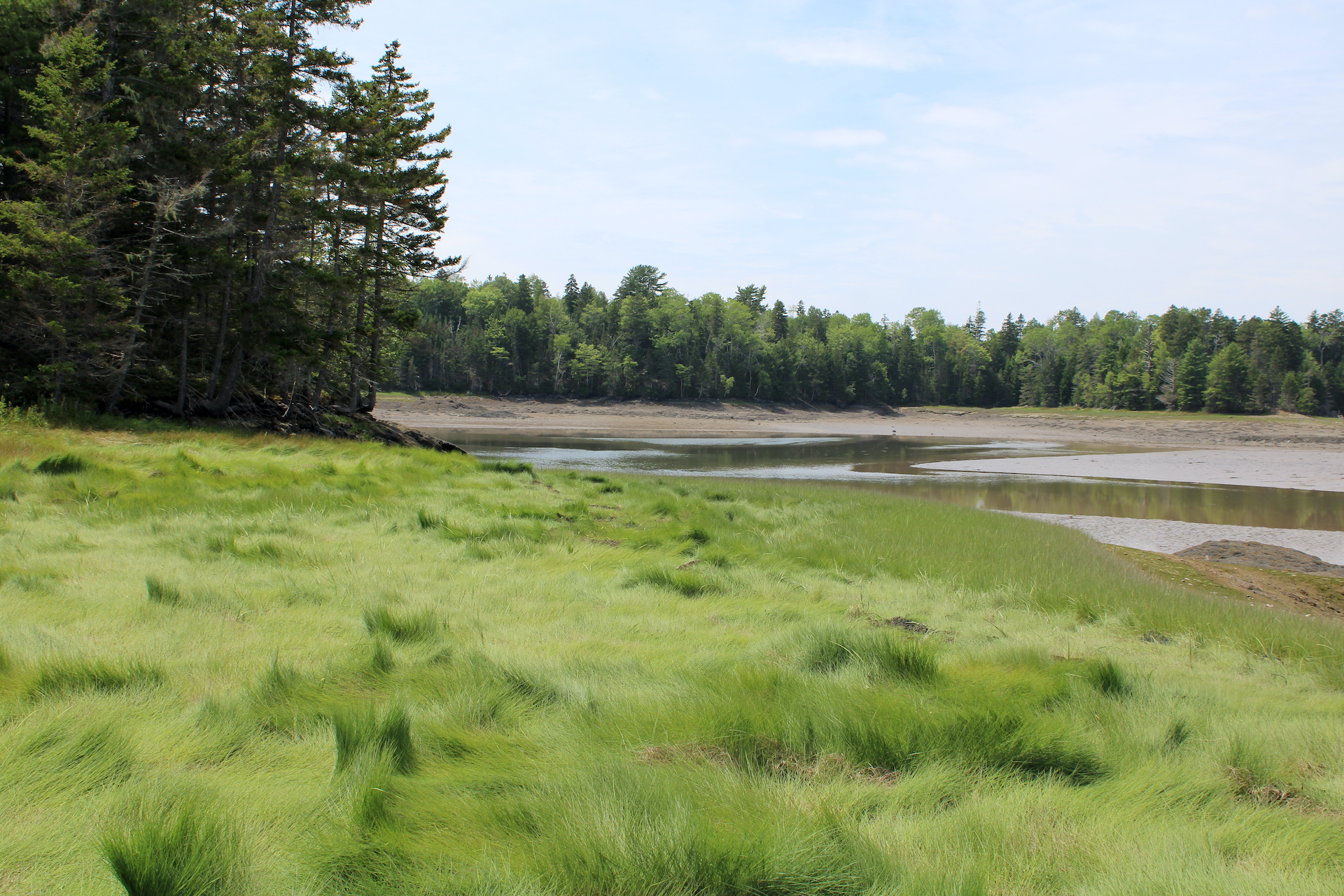
There’s a walk I’ve been eager to follow since reading about it in A Guide to the Geology of Baxter State Park and Katahdin. So on a warm day in early September, I found myself meandering downstream along the South Branch of Trout Brook.
I was fortunate to be there at that time of year. Water levels were low, which made for easy walking. Water temperatures were cool, which allowed my wet feet to buffer the heat of the day. Importantly, biting insects were few, which permitted me to enjoy the scenery without taking extraordinary measures to protect exposed skin.
A hike down the South Branch is intriguing because stream erosion exposes a series of rock formations that reveal a 400 million year-old story. In it we find the violence of long extinct volcanoes as well as the marvel of the first plants to colonize land on Earth. It is a story of immense time and change.
South Branch Trout Brook in Baxter State Park.
Maine in the early Devonian Period, about 400 million years ago, would be wholly unrecognizable. The landmasses that would become Maine were located south of the equator. Extensive volcanism scalded the Katahdin region. Terrestrial vertebrates weren’t yet a thing. Dinosaurs were still about 150 million years into the future. Perhaps the oceans would be the only similarity we could recognize.
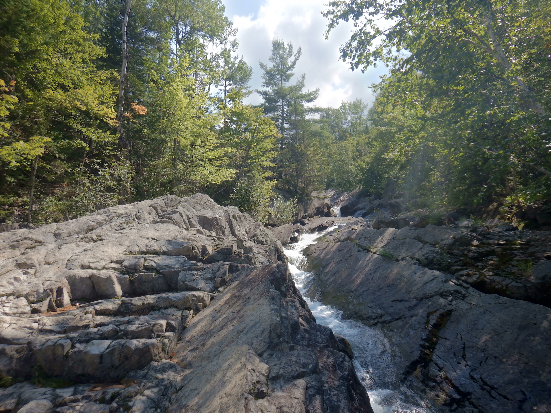
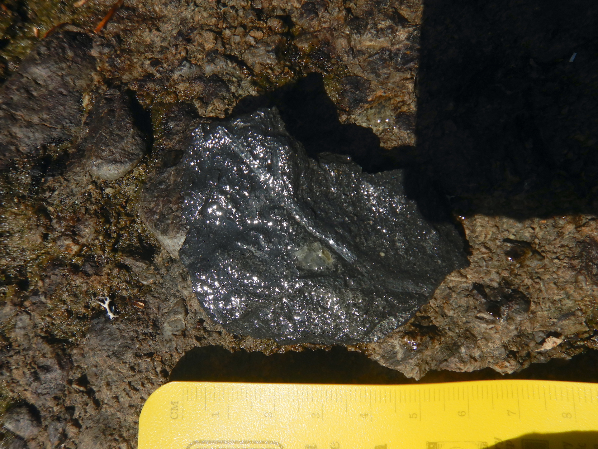
To explore this age of Earth’s past, I began at South Branch Falls which was empty of people when I arrived in mid-morning. It is an appealing swim spot with shoots and pools carved into Traveler Rhyolite, a rock formation created by ash fall and pyroclastic flows that may have filled a volcanic caldera about 407 million years ago.
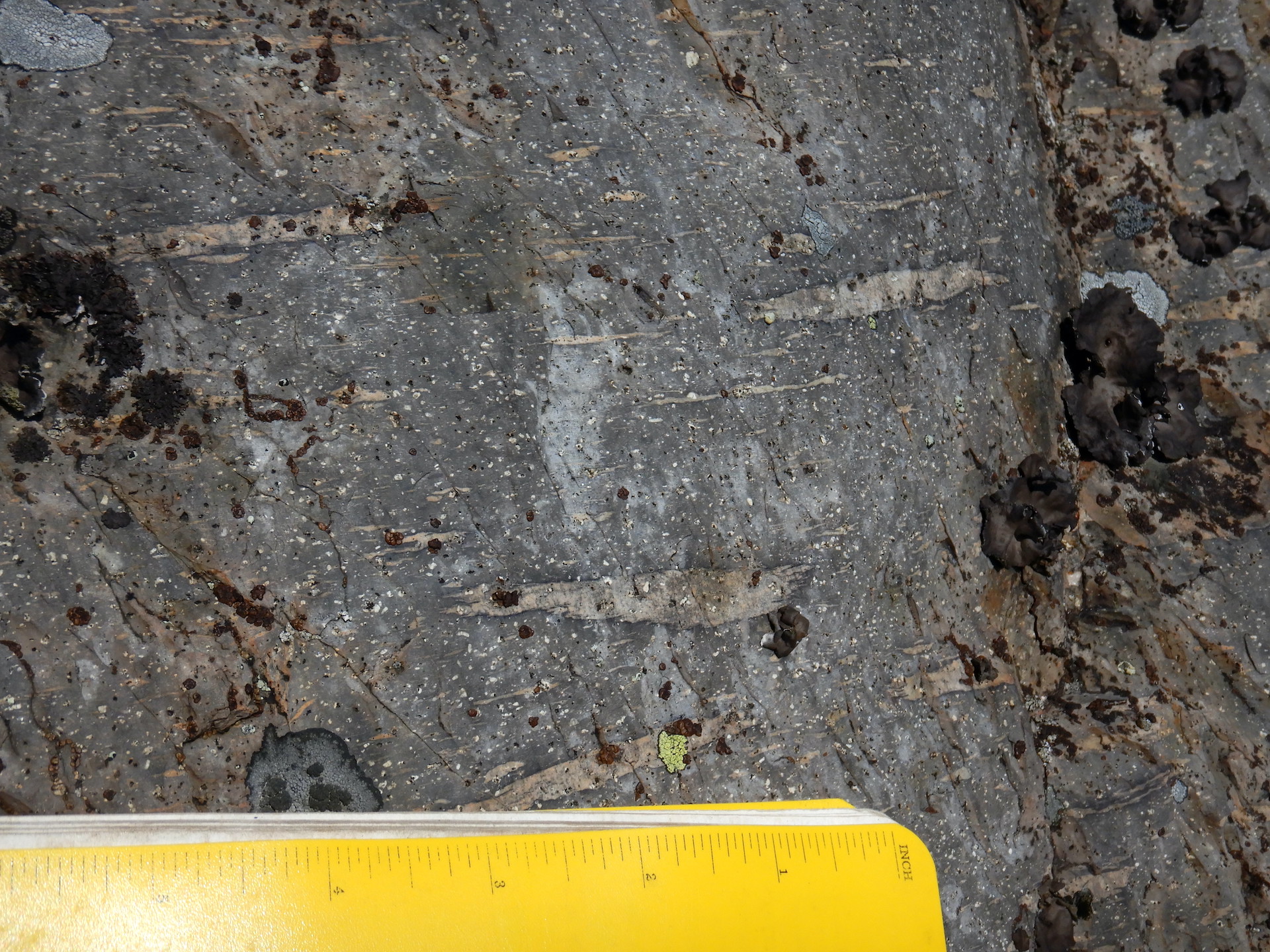
South Branch Falls. The rock is composed of a type of rhyolite known as welded tuff.An example of welded tuff from Peak of the Ridges to the south of the South Branch. While this photo was taken a few miles from South Branch Falls, the rocks formed in the same manner. Ash and pumice from volcanic eruptions were heated and compressed, which deformed and stretched clasts of pumice within it. Instead of loose ash and pumice, it was welded together by heat and pressure.
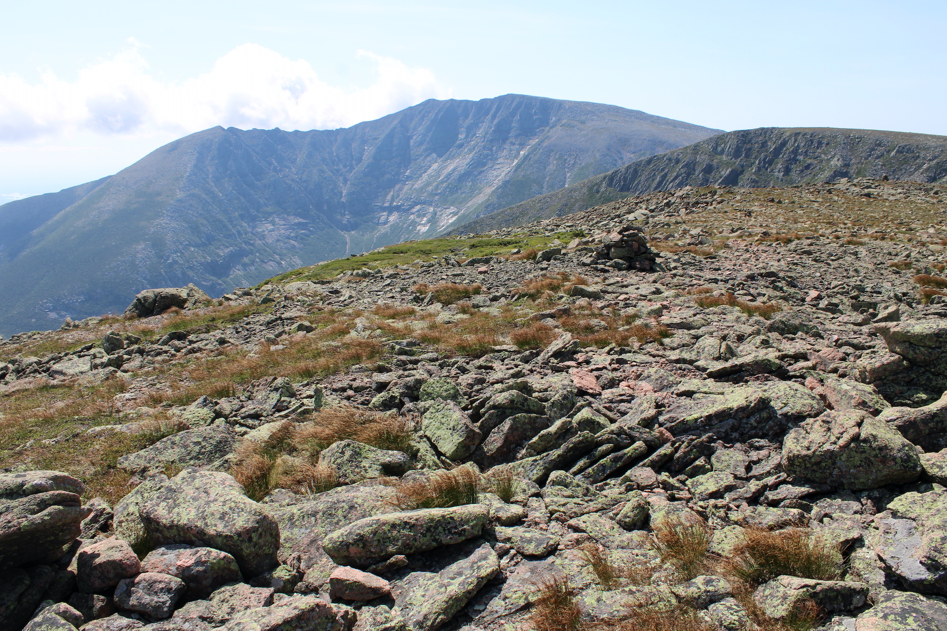
In contrast, nearby Katahdin, Maine’s tallest peak, in the southern portion of Baxter State Park is composed of granites.
Mount Katahdin as seen from the North Peaks Trail in Baxter State Park.
Despite their differences in appearance and texture, rhyolite and granite are chemical equivalents. Both are formed from silica-rich magma. The difference is a product of time and location. Rhyolite is a volcanic rock formed from viscous lava. Because of its high viscosity it tends to erupt explosively—think Plinian type eruptions such as Krakatoa in 1883. Granite, though, forms underground when silica-rich magma is given the opportunity to crystalize over millions of years. According to the aforementioned Guide to the Geology of Baxter State Park and Katahdin, mineralogical analysis confirms the relatedness of the Katahdin Granite and the Traveler Rhyolite. They both date to about the same age too, although the rhyolite must be younger since it rests on top of the granite and there’s no evidence that the granite intruded into the rhyolite. Katahdin’s granite, therefore, is the solidified core of a magma chamber that fed the eruptions resulting in the Traveler Rhyolite.
The nearest modern analog to the Traveler Rhyolite that I have seen is the pyroclastic flows of the Valley of Ten Thousand Smokes in Katmai National Park, but that was result of a single, 60-hour eruption. While Traveler Rhyolite is not a widespread rock formation currently it may have once covered a much more extensive area. It is also voluminous where it remains, perhaps accumulating to a total depth of 10,000 feet (3,000 meters) from the successive accumulations of an unknown number of eruptions. The enormity of the eruptions that created the Traveler Rhyolite is difficult to imagine. The serenity of a quiet morning at South Branch Falls fails to capture the violence of the events that created the bedrock here.
South Branch Falls.
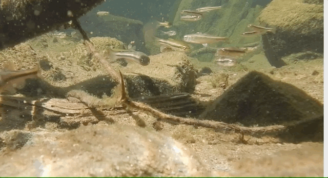
I left the falls to walk downstream before anyone arrived to wonder why I was putting my face so close to the bedrock (I’m not much of a conversationalist when out in public) but not before stopping slightly downstream to watch fish…
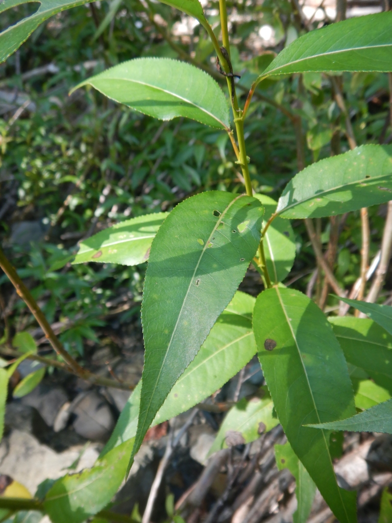
…and to identify a species of willow I had not seen before.
Summer foliage of shining willow, Salix lucida.
Much of the rock in Maine has been subject to deformation by plate tectonics and mountain building processes. Occurring between the Late Silurian and Devonian, the Acadian Orogeny saw the convergence of crustal terranes (essentially fragments of crustal plates with different geologic histories) as well as the creation of volcanic arcs and the folding metamorphism that accompanies tectonic collisions. Part of modern Maine and Atlantic Canada belongs to Avalonia, a crustal terrane that is also found in Europe from Ireland to Poland. Still more bedrock was formed under the Iapetus Ocean, an ancestral Atlantic that closed in the Paleozoic. Imagine the mess of geology which would be created by the collision of Sumatra, New Guinea, and Borneo into mainland southeast Asia by future tectonic movement. Something like that happened in the area we now call the Northeast U.S. and Atlantic Canada about 400 million years ago. The geology, as you can infer, gets complicated quickly.
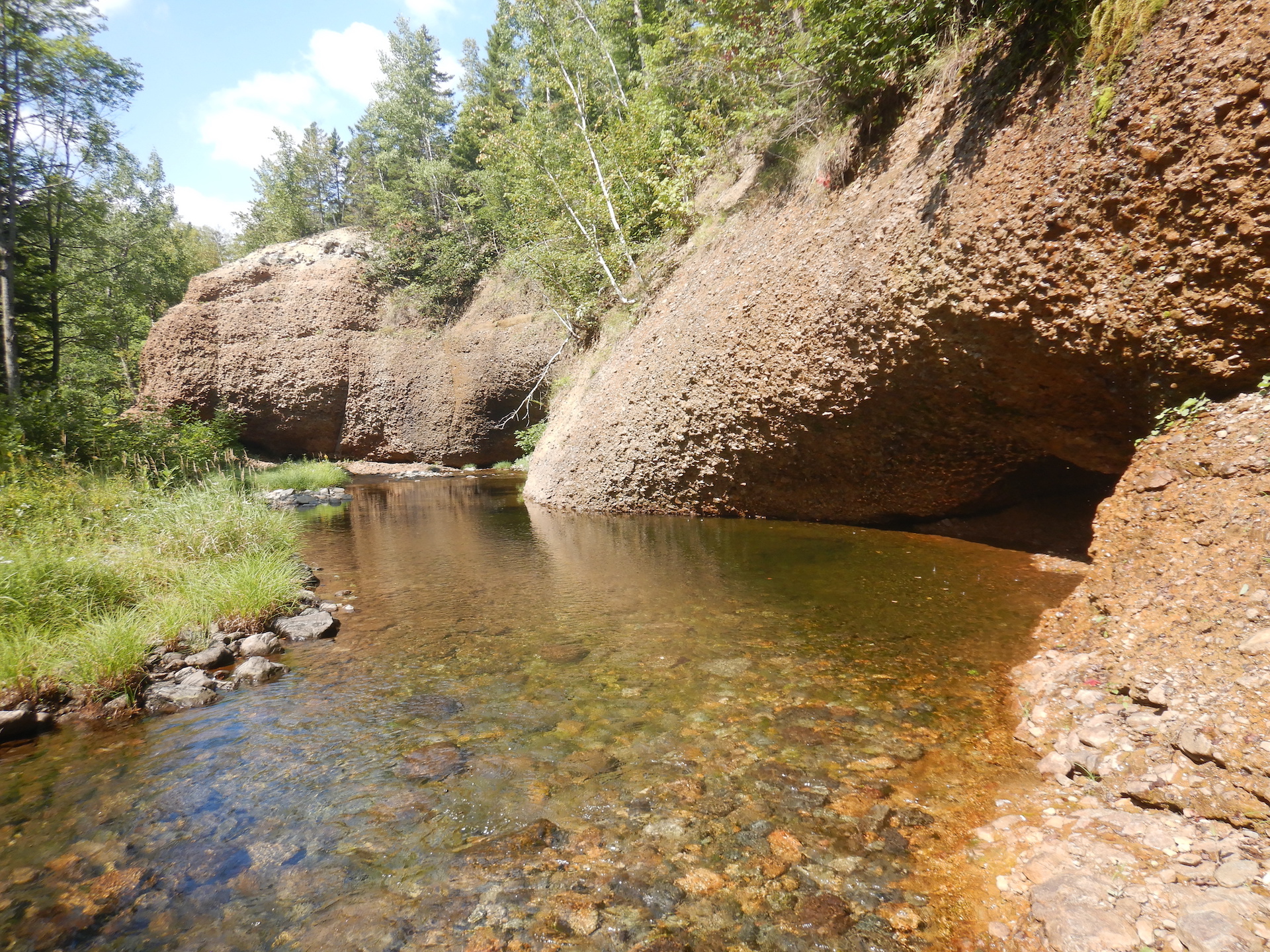
So owing to the forces formerly at work here, it is uncommon to find unaltered sedimentary rocks in this neighborhood. They are usually tilted, folded, and baked. Yet, only few hundred meters downstream of the South Branch falls the bedrock changed and we’re provided with a rare example to the contrary.
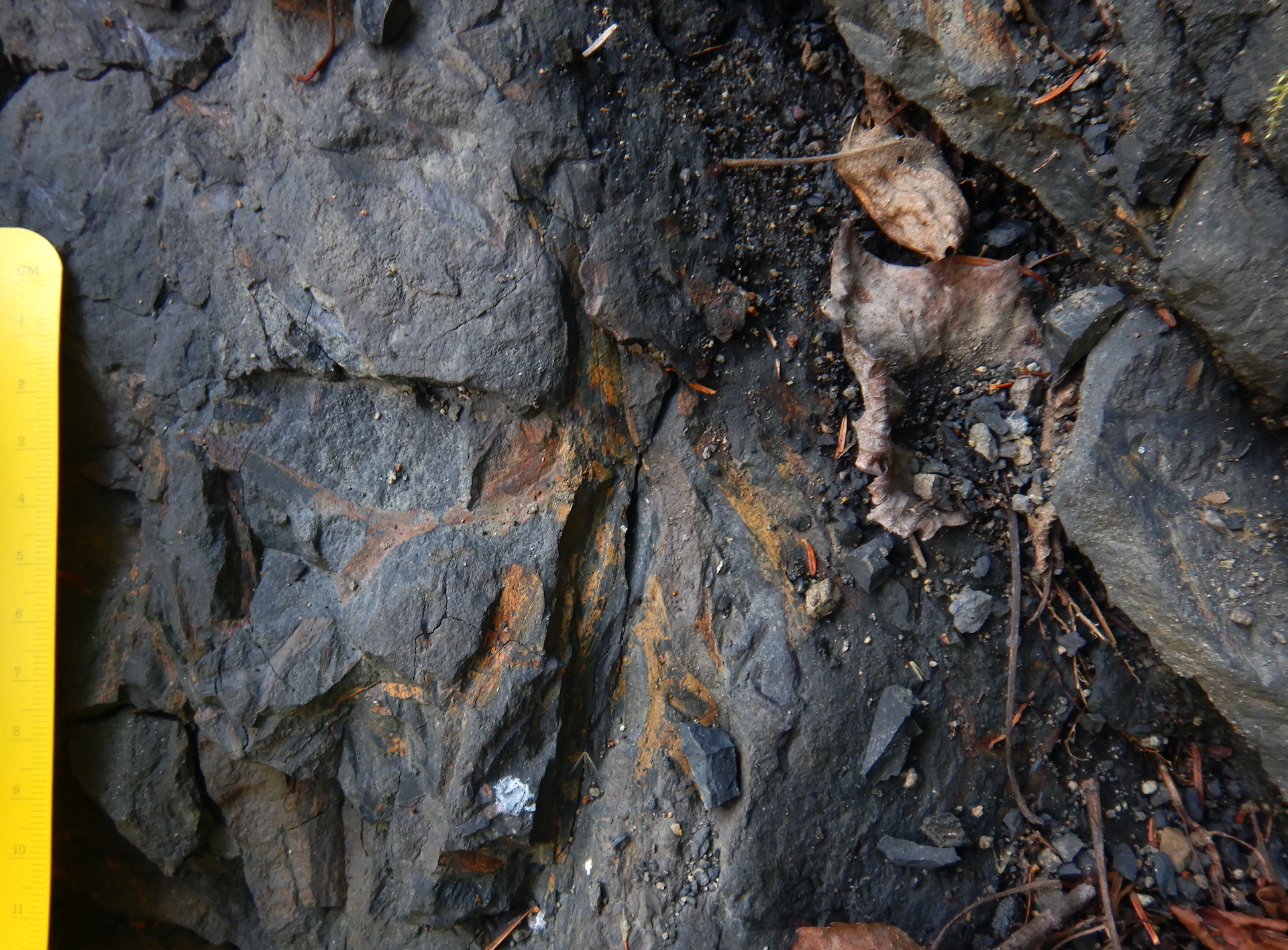
The Gifford Conglomerate is a section of the larger Trout Valley Formation, a collection of younger, Devonian-aged sedimentary rocks overtopping the Traveler Rhyolite. This is reportedly one of the few places in Maine where sedimentary rocks formed post Acadian Orogeny and haven’t been extensively altered even though they did experience some metamorphic change. With its rusty cliffs and shallow grottos, this section of stream was also particularly beautiful.
This wall of cobbles are eroded pieces of Traveler Rhyolite in a deposit known as the Gifford Conglomerate. It was emplaced during the waning epochs of the Acadian Orogeny. It’s also not found anywhere else, which suggests this spot could have once been an alluvial fan at the base of a canyon or valley on the side of a volcano.
As I continued downstream, the conglomerate disappeared under rocks with a finer consistency. As these sediments accumulated the plants growing among them seized a revolutionary opportunity.
An exposure of the Trout Valley Formation along the South Branch. Younger portions of the Trout Valley Formation do not include cobbles of rhyolite like the Gifford Conglomerate. In fact, the rock is composed of progressively finer sediments the higher one looks in the formation. Sandstones, shales, siltstones are common.
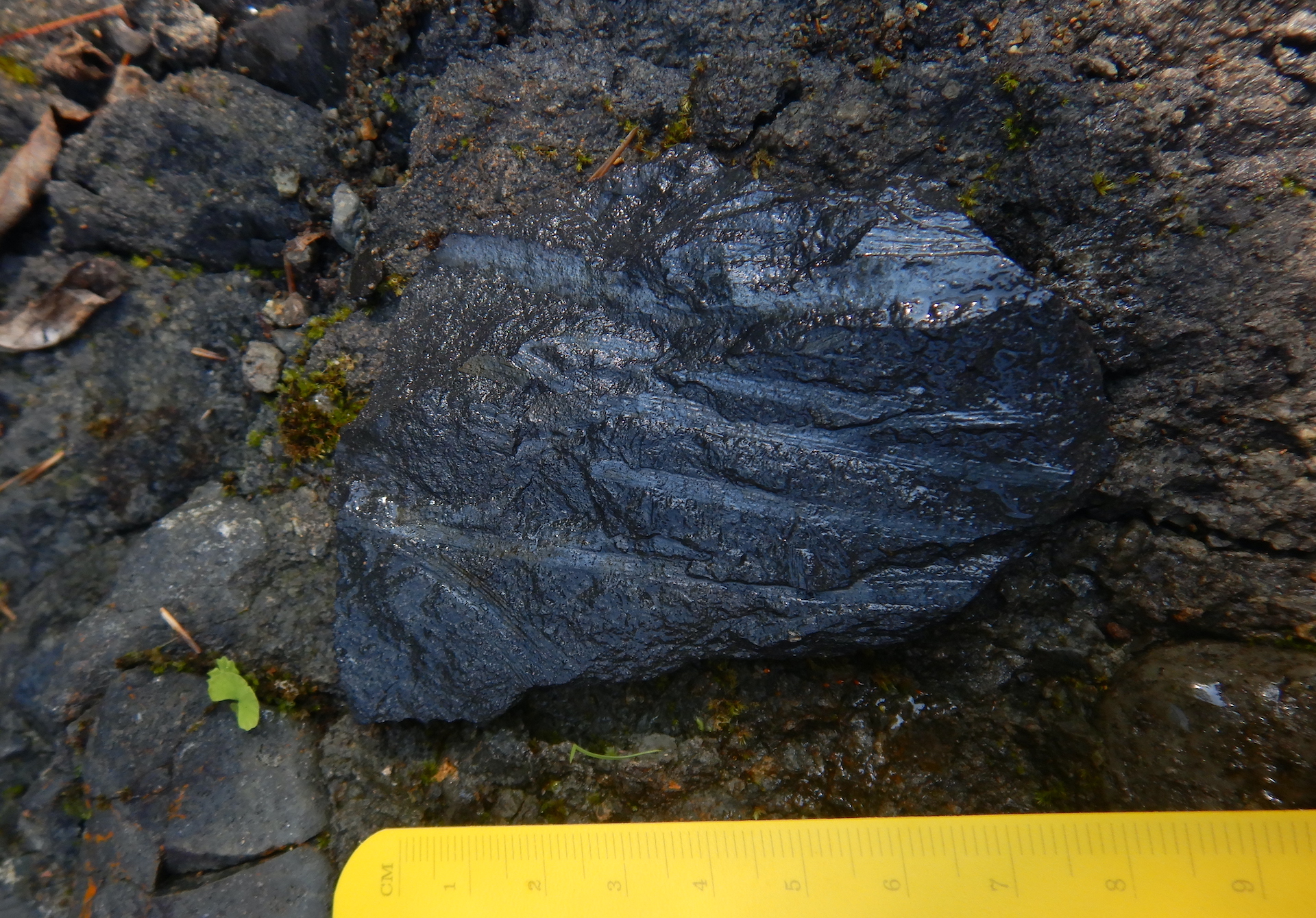
The Trout Valley Formation contains some of Earth’s oldest terrestrial plant fossils. At first, finding the fossils was a challenge. I wasn’t sure exactly where to look, but once I developed an eye for them then they popped into view.
Forests of the late Devonian included tree-sized plants, but that was still several million years into the future. The plants found in the Trout Valley Formation had only just begun the colonization of dry land and they remained small in stature. One Psilophyton species reached a foot or two (a few decimeters) in height. Another Psilophyton had dainty 3 millimeter-wide stems. Kaulangiophyton akantha (don’t ask me how to pronounce that) had almost centimeter-wide stems with irregularly spaced spines. Pertica quadrifaria is the tallest known plant of its time. It grew to be about 10 feet (~3 meters) tall with stems about 0.6 inches (1.5 cm) in diameter. They were perhaps fragile as well. Their fossils are often highly fragmented.
Sidenote: I hesitated to include any mention of fossils because certain people are dicks and steal them. But I chose to include them anyway because they are frequently mentioned in the published book I used to guide me. The state park also has a publication noting some fossil locations online. Athough collecting is prohibited in Baxter State Park, there is still a risk someone will read this and steal fossils. Please don’t be that guy. Leave the fossils where they are for others to enjoy and study.
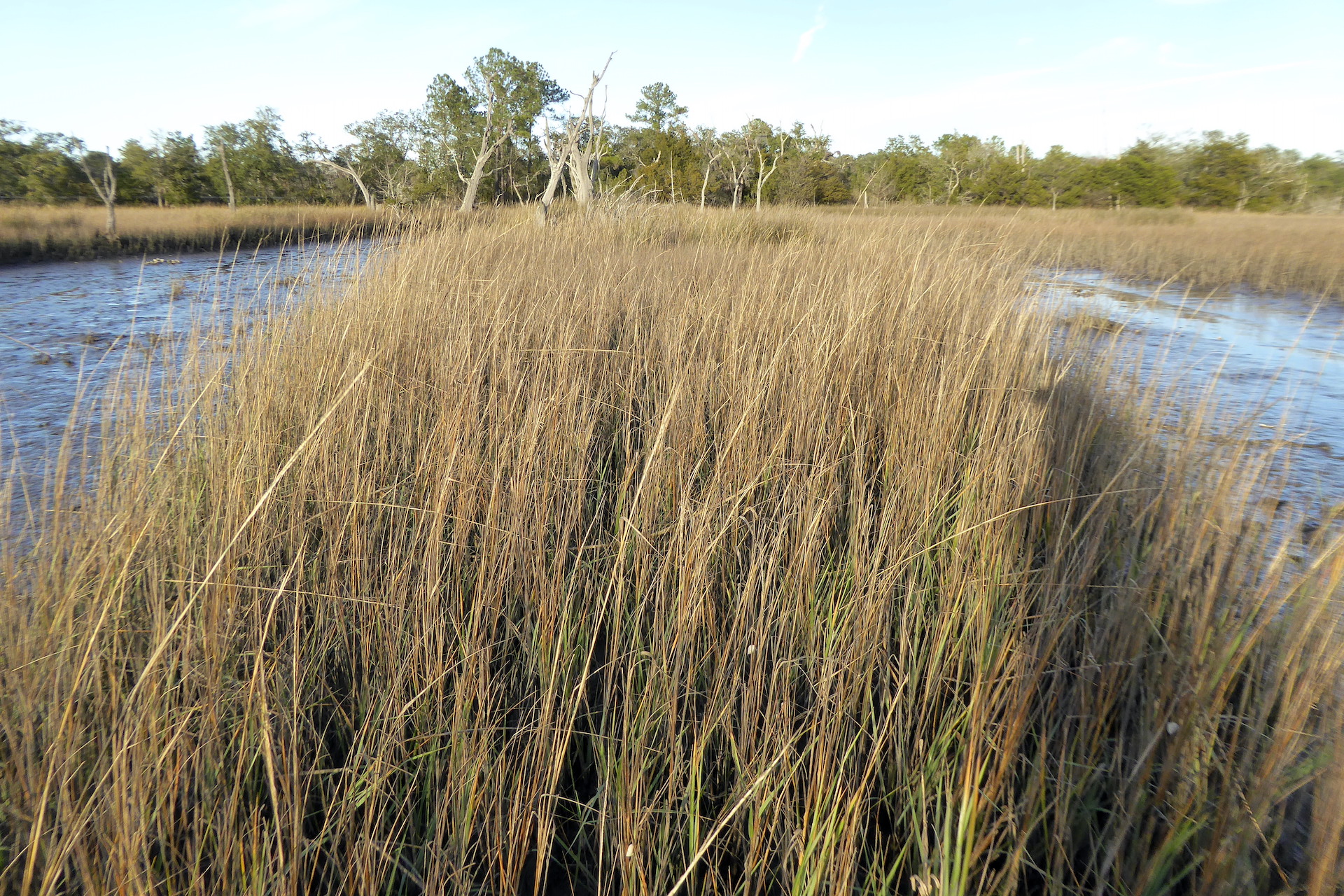
So here are 400 million year-old plant fossils comprising few to several species found in finely grained sediments. What might this tell us about the habitat they lived in? The authors of one of the first papers to formally describe the fossils, published in 1977, stated, “The number of plants found at a single site is very small, usually only one species, occasionally two or three at most. There seems to be a valid comparison with present-day marshland vegetation along the New England coast where the number of species is relatively small over much of the area with scattered peripheral patches of other species that occupy smaller niches in the landscape.” When I read that I immediately thought, “Hmm…sounds like a salt marsh.”
A salt marsh near Charleston, South Carolina.
Salt marshes are harsh environments for plants. For most species, it is an uninhabitable space. Vegetation must be able to survive flooding by tides, oxygen-poor soils, and high salinity. But for the plants that possess the physiological adaptations to cope with the challenges, the salt marsh becomes a richly productive environment.
On the east coast of the United States, salt marshes exist in the wetland transition zone between the sea and land. Salt marsh or smooth cordgrass (Spartinaalterniflora) dominates the low marsh, the area flooded by tides each day. It grows in sand, clays, and mud. It can tolerate salinities that are double that of sea water by excluding salts from entering its roots, sequestering of sodium in its tissues, and secreting excess salt through its leaves. It counters a lack of oxygen in the soil with stems and roots connected through air pockets. No other plant in its native range copes as well with the salt, flooding, and disturbances that cordgrass experiences.
While smooth cordgrass dominates the low marsh, salt meadow hay (Spartina patens) outcompetes it in places above the average high tide line. Salicornia, a tasty edible, finds space in salt pans where conditions can be too harsh for even the Spartina grasses. When I learned to recognize the dominant plants of salt marshes while working at Assateague Island, I could use that information to note at a glance the approximate average high tide and the driest, saltiest places in the marshes. In east coast salt marshes, the few thriving species grow in habitats that differ in salinity and tide exposure.
A meadow of Spartina grasses in Pembroke, Maine. The cow-licked grasses are Spartina patens (i.e. salt meadow hay) that live in the high marsh. Just to the left of the S. patens is a border of S. alterniflora (i.e. smooth cordgrass) that marks the low marsh.
Might the first plants that took to the land in the Devonian have created habitats that resembled salt marshes? I do not possess the ability, imagination, or knowledge to adequately envision those environments. But that won’t stop me from trying. There were no grasses or flowering plants or even seed-bearing plants in the Devonian so the scene was different. Even so, perhaps a series of extensive mudflats and braided streams flowed into the sea on the edge of an eroding volcano. Maybe some of the now fossilized species were best adapted for habitats closer to fresh water. Others could have preferred spaces inundated by tides. Disturbance and competition may have partitioned them into habitats perfect for some and harsh for others.
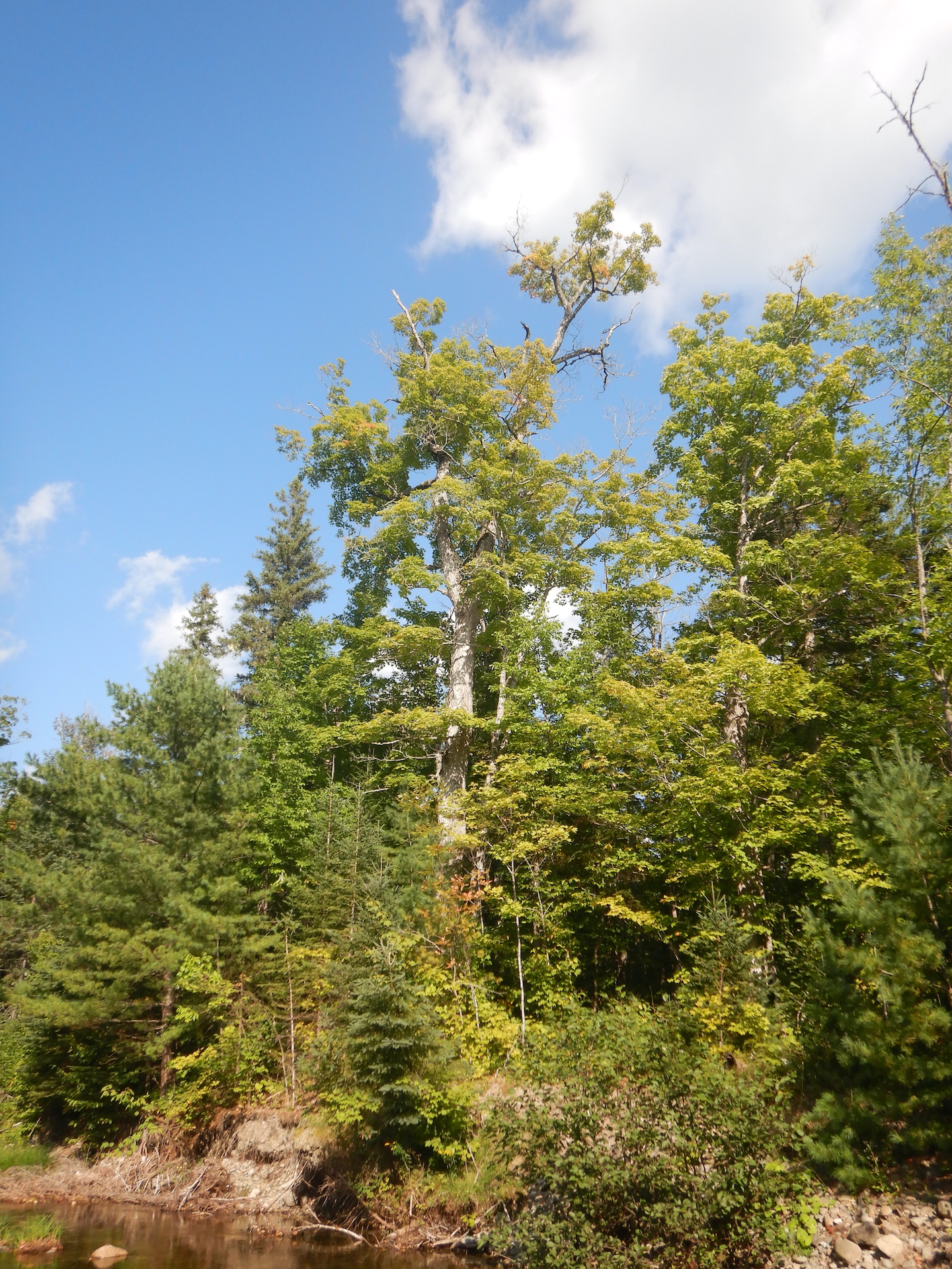
After continuing downstream where most of the Trout Valley Formation became hidden under a veneer of glacial till and not far from the South Branch’s confluence with the main stem of Trout Brook, I paused to admire a large sugar maple.
A beauty of a sugar maple along the lower reaches of the South Branch.
Perhaps 75 feet tall, its broad crown of leaves included the first hints of fall color. The tree was a fine representative of its species. A world without sugar maples would be a poor one, I think, and the humble fossils I examined upstream represent a beachhead for land plants to eventually become beings as magnificent as maples. In the Devonian, terrestrial plants began to stabilize landscapes from erosion, create soils rich in nutrients, and provide food for arthropods and vertebrates. It might’ve been the first time in Earth’s history when an organism with my oxygen needs could have breathed the air and survived.
Each fossil I found was a plant that grew for months or years. It died during a specific point in time at specific place. In contrast to the collective millions of years preserved in the rocks and the hundreds of millions of years of evolution represented by the maple tree and me, each fossil represents single moments of life and death. They are, paradoxically, the past and the present and the future.
Although this is an ancient story, I’m not sure “ancient” is an appropriate adjective for it. In my mind, the word implies a connection to human antiquity, while this story of change is a chapter of Deep Time. It is part of the arc of Earth history before humanity’s evolved ability to conceive of it. We can, though, draw a metaphoric line between the volcanoes that once blanketed the area under thousands of feet of ash to the plants which grew in tidal marshes to the forests that now bath my lunges in oxygen. I might live in a different world, but my existence remains rooted in the events preserved in these rocks.
Think of a mama bear. What does that idea conjure in your mind? Perhaps it is fierceness, since mother bears are ornery and defensive when necessary. Maybe it is commitment, because mother bears dedicate years to raise a single litter. Perhaps it is sacrifice, since mother bears provide cubs with time and energy that could otherwise serve to promote her own physical health.
We’re fortunate to watch many different female bears at Brooks River in Katmai National Park. Yet there is one whose maternal efforts are legend. One who can fish successfully almost anywhere. One whose fearsome reputation is long-lived among other brown bears, including large adult males. Don’t get in her way. Don’t lurk near her fishing spot. Don’t look at her cubs. Do give 128 Grazer your 2023 Fat Bear Week vote.
Grazer | ɡrāzər |
(2005 – Present) A female brown bear documented to use Brooks River in Katmai National Park, Alaska. Also known as bear 128.
verb. [with object] The effort of a mother bear to maul or attack another bear with little provocation, especially in defense of her cubs: She grazered him.
Origin: Bear cam slang. Circa late 2010s and early 2020s.
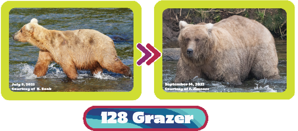
Grazer is famous among people and (maybe) infamous among brown bears for her extraordinary defensiveness. When she arrived at Brooks River in 2016 with three cubs representing her first known litter, she would confront and attack other bears with little or no provocation. Sometimes it appeared that another bear only had to look in her family’s direction to draw her ire, as bear 83 knows well.
Her behavior didn’t mellow when those first cubs grew into yearlings the following summer. Nor did she rethink her aggressiveness toward other bears when raising her second litter. While mother bears can change their parenting strategy as they gain skill and experience, Grazer continued on the path forged with her first litter—the best defense is a good offense.
Grazer separated from her most recent litter at the beginning of summer 2023. Since then, she’s lived a brown bear bachelorette’s life. Her pheromones attracted the attention of male bears during the mating season. They chased her tail, with varying degrees of success, right bear 164? After the mating season, and also during it, she focused on eating. A lot. Her waistline carries the weight of her success.
Grazer’s formidable reputation carried into this summer. She ranked high in the hierarchy among bears and was perhaps the river’s most dominant female. Notably, 151 Walker deferred to her frequently in early summer. Walker is a big dude and he’s not shy about displacing bears from preferred fishing spots. Bears have good memories, though. Maybe he had too many bad experiences with her in the past and didn’t want to risk more dangerous confrontations.
In this video, Walker is in full dominance mode as he works to displace another adult male at Brooks Falls. But watch his behavior when Grazer shows up on the boulders above.
And in case you need more examples of Grazer bulldozing bears, here you go. (Watch with sound on for the full effect.)
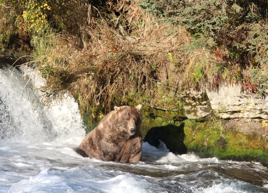
During my brief time at Brooks River early last summer, I watched bears fish largely without success because the expected salmon run was slow to arrive. Some of the big guys caught some fish. 747, for example, sat at Brooks Falls like he always does and let the fish come to him, but even he wasn’t catching many. Most other bears fared worse. They roamed from one place at the river to another, searching for the few early arriving salmon.
Grazer, though, has practiced—no, perfected—her fishing tactics in many different places. If fish are jumping Brooks Falls, she’ll catch them there. If there’s space in the waterfall’s far pool, she’ll catch them there. She’ll work the jacuzzi below the falls. She’ll fish in the middle of the night. She’ll use her strength and agility to chase down salmon.
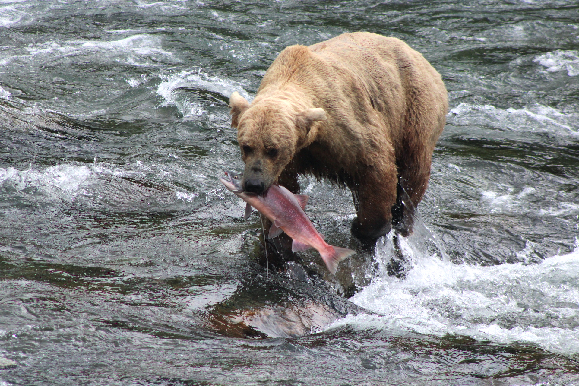
One evening last summer, I stood on the riffles platform watching her work the river in front of me. While the riffles provides brown bears with fishing opportunities, it is often a more challenging place for bears to catch salmon than the falls. The riffles doesn’t provide the same pinch points in topography as the falls and salmon have many escape routes. There aren’t many bears who can make the best of that situation consistently, especially when few salmon are in the water and bears are forced to run through the water to get them.
Grazer parks herself on the near bank upstream of me. She moves into the water after several minutes and spots a lone salmon. She lunges and misses. She chases. Another lunge, another miss. She continues running at full speed through the water while somehow keeping an eye on the salmon. With a final lunge, she fully submerges into a two to three-foot-deep pool and surfaces with the salmon in her jaws. I can see the fish gasping in the air as blood runs from deep puncture wounds in its body. Grazer eats all of it—tail to head—even the gill plates and mandibles.
In early summer when few bears were catching salmon, Grazer found success. She is perhaps the best angler at Brooks River.
Bear 128 Grazer with a catch in the riffles on July 6, 2023.
Let’s not lose sight of Grazer’s goals either. She’s working to build the fat reserves necessary to sustain her survival during winter hibernation. She’s also building fat in case she gives birth in the den. Bear cubs are born mid winter while mother hibernates. Abundant fat reserves are necessary for mother bears to reproduce, so getting fat is vital to a bear’s reproductive success.
In a way, my 2023 Fat Bear Week endorsement is a recognition of Grazer’s full-bodied and fat-addled collection of work since 2016. When she is raising cubs Grazer is the archetypal mama bear. She’s formidable, strong, brave, skilled, and successful. She deserves your vote in Fat Bear Week 2023.
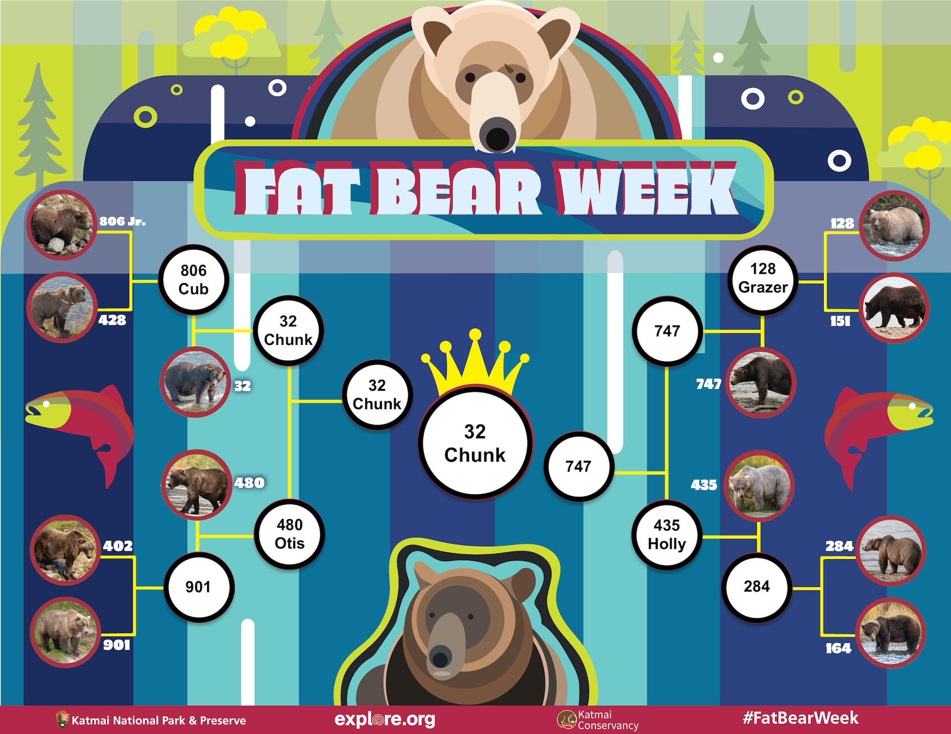
My Fat Bear Week bracket predictions for 2023. Yes, yes, I know. I don’t predict that Grazer will win. There’s a difference between who I think should win and who I think will actually win, after all. Which bear’s corner are you in? Download your bracket from FatBearWeek.org.
While every season has much to admire, I find springtime especially enthralling. Something new appears nearly every day. At first, maple sap runs heavy during March’s warm days and sub-freezing nights. Around then, a trickle of meltwater in a ditch and a bare patch of matted leaves on the edge of a snow bank promise room for other plants to break dormancy. Soon after, the first golden catkins appear on the hazelnut and gray alder. Rainy evenings bring amphibians out of hibernation. In a short time, the soon-to-flower ephemeral herbs emerge from the crust of leaves. By late April and early May, the forest canopy bursts to life again with bird song, the blossoms of red maple and quaking aspen, and finally the unfurling of leaves that will soon thoroughly shade the ground where I trod.
Each of these are little events that promise a lot more. I’m unsure if non-human animals contemplate these changes like I do. Yet, I’m certain they pay attention to them. Black bears, recently emerged from their dens, know the pattern and are eager to exploit the change of the season to their advantage. If I’m lucky, their efforts to find their first substantial meals of the year might allow me to investigate what they are up to.
A section of Katahdin Woods and Waters National Monument sits to the east of Sebois River. It’s a quiet area of the park since there are no campsites, less than a mile of developed hiking trails, and only a few maintained roads. Bicycling through it is fun and is made even more enjoyable when I afford myself the time to go slow and pay attention. It’s one of the best places in park that I’ve yet found to look for bear sign in the spring.
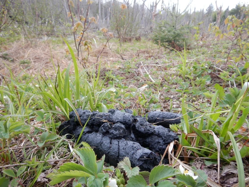
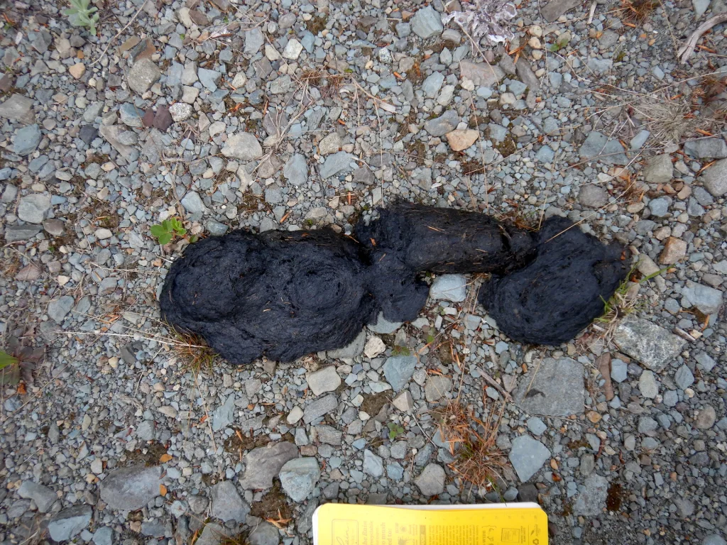
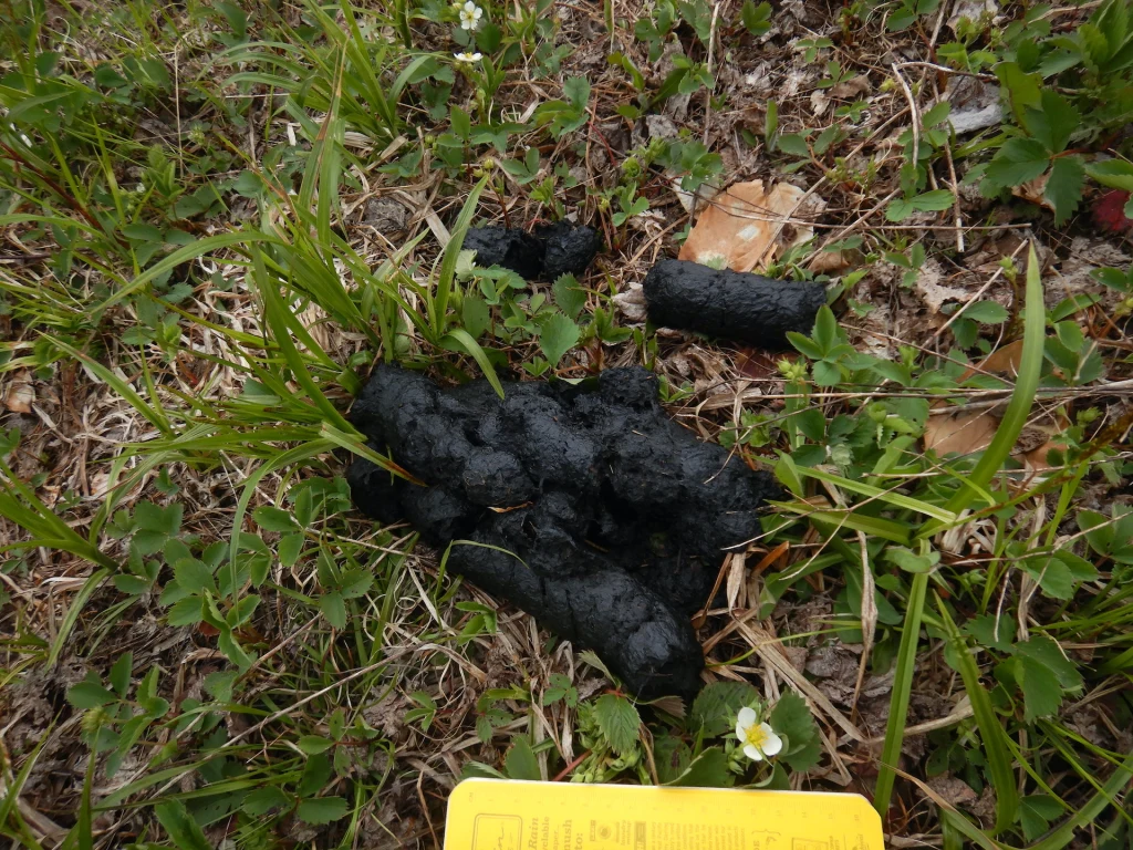
Riding the single lane spur that loops off and back to American Thread Road last weekend I came across many piles of bear scat, which I was hoping to see. Not because I particularly admire turds, but because bears are cryptic here. They are frequently hunted throughout northern Maine and consequently have a substantial fear of people. The thick forest also limits my ability to watch a bear if I happen to see one. The signs that bears leave behind—such as marking trees and scat—are like pages in a book. A single page may not reveal much but look at enough pages and you’ll get a good story.
In particular, scat can reveal how recently a bear was in the vicinity and what it was eating. Black bears are omnivores that are well adapted to survive on plants, and the vast majority of their annual calories come from plant foods. In north-central Maine, though, there are no calorie-rich berries to eat in the spring. Perhaps there are some leftover acorns, but oak trees are not common in the forests as this area is near the northern end of their range in the northeastern U.S. So other plant foods are a bear’s best springtime bet.
While a black bear’s digestive track remains essentially one of a carnivore, it utilizes adaptations such as an elongated gut and slightly flattened molars to extract nutrition from tough to digest plant foods. A bear also consumes plants when they are most nutritious and digestible. Newly emerged green vegetation like grass, sedge, and clover contains relatively high amounts of protein, for example. As those plants mature, protein content declines while indigestible fiber increases. Fiber helps keep the bear on a so-called regular schedule, but the bear is really after the protein. Even though hibernating bears maintain their muscle health without eating or exercise, if they’ve exhausted their fat reserves by springtime then their body is forced to tap into their lean tissue reserves. Young, tender veg helps bears stave off muscle loss and even build muscle before sugary, fat-building foods become available in mid to late summer.
All but one of the scat piles I found were filled with herbaceous plants. Although most looked older than a day–when bears eat green veg, the resulting scat quickly oxidizes when exposed to air to form a black surface crust–this was a promising sign. I knew that the lightly used roads are good travel corridors for bears and the sunlight reaching the road edges allows vegetation to green-up more quickly than the forest interior, which attracts bears to the roadsides. Perhaps I might see a bear if I pedaled slowly and remained observant.
The effort paid off near the crest of a hill when I spotted a dark mass of animal on the edge of the road. I stopped to watch.
The wind was at my back, which is a welcome push when cycling uphill but also carried my scent to the bear. Once it caught my scent, the bear only needed a couple of seconds to decide to run into the forest. Had the wind been blowing the other way, I probably could’ve watched it much longer with less chance of disturbing it unintentionally. Still, I was grateful for the moment and the small insights into its world.
Before widespread logging and, later, roadbuilding encroached on the area’s forests, grassy areas in northern Maine were likely much less common than today. Black bears always sought the first spring greens, but they had to look in other places—riverbanks, stream sides, and beaver meadows for example. They continue to go to those areas, of course, even as roadsides have opened another foraging opportunity. Roads are risky places that expose bears to people though. Bears weigh the risk along with the potential reward of a good meal.
I knew the bear I saw was eating well even as it still had a long way to go until it was fat enough to enter its winter den next fall. Its effort is a journey recorded in its scat—pages, if you will, in the Book of Turds.
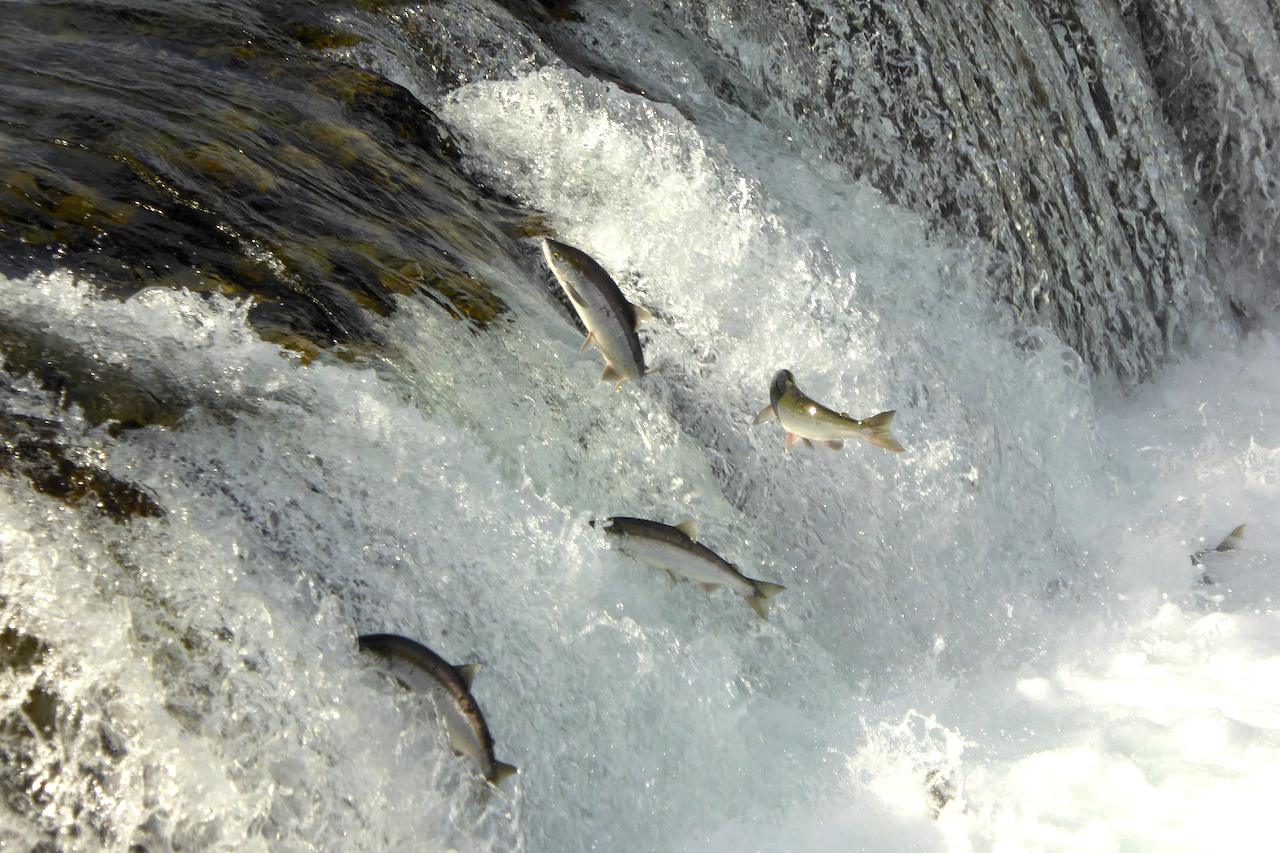
Brooks River in Katmai National Park, Alaska is historically, culturally, and ecologically unique. The river corridor has harbored Alaska Native peoples for thousands of years, is one of the densest archeological sites in Alaska, and remains a place of profound significance for Alutiiq descendants of former Katmai residents. The underlying geology records stories of great volcanic and glacial change. Hundreds of thousands of sockeye salmon annually use the river for migration and spawning. And, during the last 40 years it has become especially famous for its brown bears and wildlife viewing opportunities. There’s no other place like it.
Bear 482 Brett searches for salmon in Brooks River while her two cubs hang on for the ride. July 14, 2021.
Brooks Camp is also experiencing more people than ever before.
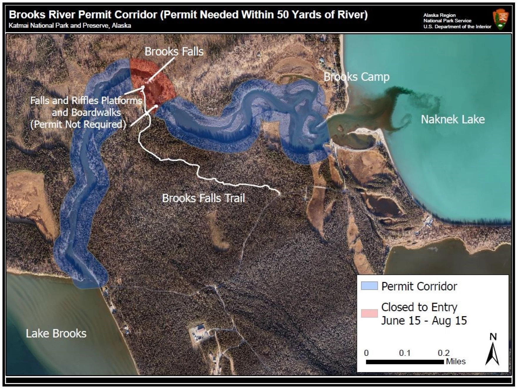
In the midst of skyrocketing visitation last year, Katmai National Park implemented a pilot permit program for Brooks River. The permit system didn’t change wildlife distance regulations at Brooks River or limit the overall number of people who could visit. Instead, it applied only to those who wish to physically enter the river or its banks outside of the designated trails, roadways, bridge, and platforms. No one needed to reserve a permit unless they planned to enter the river or walk off trail along the riverbanks (two activities that I suggest should be avoided to give bears the space they need).
The pilot program appeared to be successful. It provided National Park Service (NPS) staff with an additional opportunity to communicate the special circumstances, rules, and responsibilities that apply to Brooks River. The NPS could revoke the permit in instances where permit holders did not adhere to wildlife distance or fishing regulations, which effectively prohibited the person(s) from reentering the river. It allowed approved Brooks River Guides to continue to give their clients the mandatory bear-safety orientations. And finally, it did not restrict or interfere with subsistence fishing associated with the traditional redfish harvest.
Now, the NPS is looking for public comments about the permit system. If you have the time and care about the bears who make the river their summer home, then please support the plan with a comment on or before April 28. As the Katmai Conservancy suggests, say yes to the permit and ask the NPS to limit the number of permits on a daily or weekly basis.
Why are permits necessary? The relative ease and accessibility of the bear-viewing experience at Brooks Camp has attracted increasing numbers of people. More than 16,000 people visited in 2022—an all time record high—and almost double the visitation of 2008. Brooks River is a mere 1.5 miles (2.6 km) long, yet dozens of brown bears use it during the salmon migration and spawning seasons of summer and early fall.
People who enter in the river directly occupy the habitat that bears need to fish for salmon. Numerous scientific studies (reviewed here) have documented that human recreation can displace bears in time and space. The presence of people can cause bears to switch from diurnal to crepuscular activities in response to bear-viewing, angling, hiking, and camping. Bears decrease in number and are present for shorter time spans when exposed to people, angling, and bear-viewing. Bears also spend less time fishing and have less fishing success when anglers and bear-viewers are present.
Bears gather at Brooks River to fish for salmon. People in Brooks River risk displacing bears from important foraging areas in the river. This is especially true for bears who do not habituate to our presence. In these situations, we unwittingly become a competitor in the bear’s mind for space, and most of the time that bear won’t challenge us for it.
Studies specific to Katmai National Park have found that the presence of people can affect when bears fish (Olson et al. 1998) and cause bears to avoid or alter their use of foraging areas (Rode et al. 2007; Smith 2002; Turner and Hamon 2016). Therefore, even a small number of well-behaved and well-intentioned people in the wrong place (like in the river) can have a disproportionately negative effect on brown bears. Disturbance of wildlife can also result in decreased visitor satisfaction (Skibins et al. 2012) and create user conflicts between visitors who are recreating in different ways (bear watching from the platforms or online via webcams vs fishing or photographing bears in the river).
Importantly, and tucked away in the park’s newsletter about the permits, is this: “There is no limit established to the number of permits issued during the permit-required time frame currently, but this will be considered if public feedback to the plan supports a limitation or if conditions change within the Brooks River Corridor to warrant a limitation.” Therefore, I recommend that comments ask the NPS to go beyond merely requiring permits. Comments about the permits should encourage the NPS to establish limits to permits on a daily or weekly basis and perhaps even greater seasonal closures to Brooks River to adequately protect habitat for bears.
I didn’t visit Brooks River in person last year, but rangers and some people I know who had traveled there reported to me that the pilot permit system worked well. While it does not address over-crowding and congestion issues at Brooks Camp caused by record-high levels of visitation, it is certainly a big step in the right direction to ensure the river’s bears have access to the habitat they need to survive. None of the existing regulations would change at Brooks Camp. The permits only make it easier for the NPS to enforce them. But permits alone are not enough. Existing protections for bears can be made more effective if permits were limited in availability. Our national parks, and indeed Brooks Camp, cannot support unlimited numbers of people. The Brooks River corridor is a small area overall. It has limited space for bears and a limited carrying capacity for a high-quality bear-viewing or fishing experiences. Please let the NPS know you support their efforts to protect habitat for bears in the river through the permit system and that the number of permits should be limited on a daily or weekly basis when bears are actively fishing in the river.
This may seem non-controversial. After all, wild animal populations are made of individuals just like human families and communities are composed of individual people. But this idea hasn’t been accepted widely among scientists and managers of national parks.
Thankfully that tide seems to be turning, and I’m pleased to be able to contribute to this scientific effort. Results from a survey of bear cam viewers on explore.org show that people who care about Otis and other individual bears are more likely support conservation efforts for brown bears compared to viewers who do said they could not identify individual bears. Please head over to my post on explore.org to learn more.
Bear 480 Otis sits in his office at Brooks Falls in Katmai National Park, Alaska.
I’d like to thank the researchers who made this study possible—Jeff Skibins (who drafted this paper and did the data analysis) and Lynne Lewis and Leslie Richardson (who were instrumental in the survey design and implementation). I’d also like to thank the Katmai Conservancy for covering the expense to make the paper available to everyone through open access.
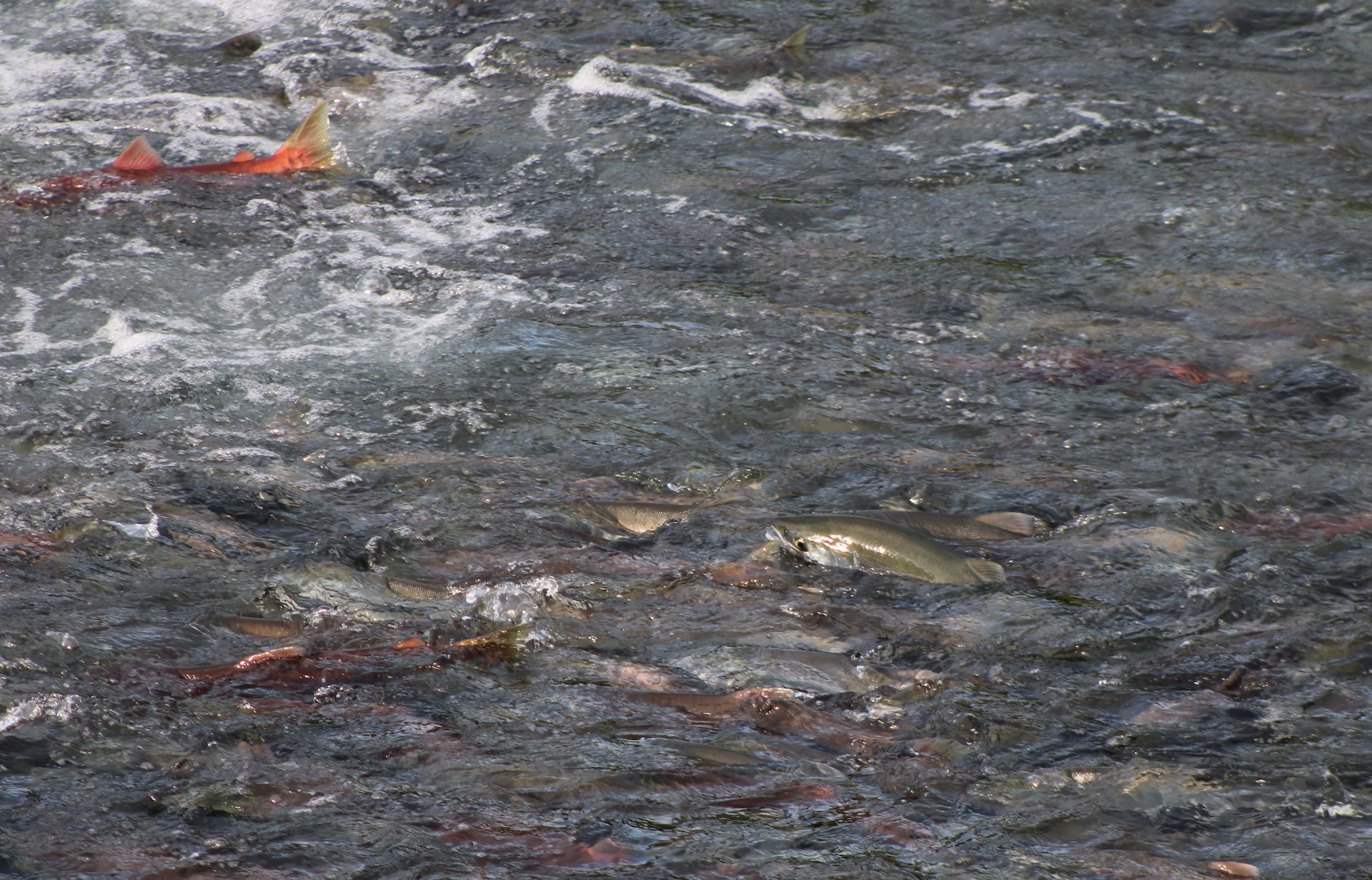
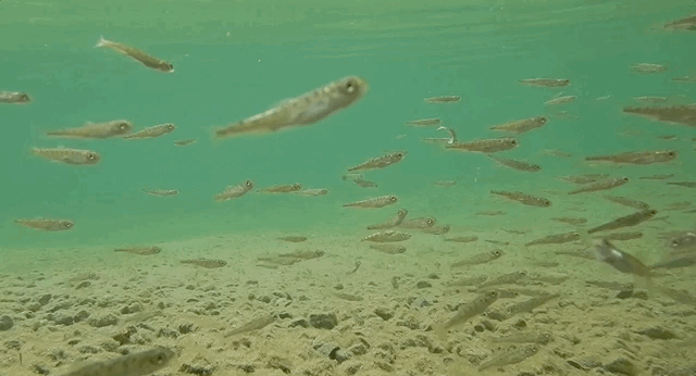
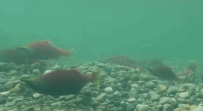
Seventy-nine million salmon returned collectively to Bristol Bay in 2022, setting a new record high for the region. Bristol Bay’s wholly intact watersheds make this possible. Water flows freely from snowmelt-fed rivulets and springs high in the mountains through the chains of lakes that occupy glacially-carved basins and into the lower stems of rivers that empty into the Bering Sea. Adult salmon swim upstream without encountering human-made obstructions or water diversions. And, instead of being displaced by shore-line hardening structures to protect buildings or roads, such as it is throughout much of the U.S. west coast, billions of salmon fry in Bristol Bay find ample refuge in the slack-waters along stream margins, grassy marshes, and lakes. Vast numbers of salmon don’t even see a bridge during their entire lives. The diversity and health of the watersheds make Bristol Bay whole.
I was late to the Pebble fight, only learning about the proposed mine in 2007 during my first summer as a park ranger in Katmai National Park. But many people in the Bristol Bay region have been advocating against Pebble Mine for 20 years. I hope the fishing boat captains and their deck hands; Alaska Native Tribes, village councils, and coalitions; lodge owners, employees, and fishing guides; chefs; scientists; those who work for non-profit and conservation organizations; and many others have the opportunity to rest well for at least a few days now that the threat of the mine is no longer looming. I thank them for their work.
Before I had the fortune of living in the Bristol Bay area, I did not understand—or even fathom—the importance of salmon to place and people. The calendar in Bristol Bay is centered on salmon. The region’s economy is centered on salmon. Its ecology is centered on salmon. And it works, beautifully.
I’ve said many times before that our world is wounded. Too much of humanity seems to have a unique desire and capability to consume land, habitats, material without considering the rights of other creatures or the value that future generations of people might place on those things. I wish I could take everyone to Bristol Bay at the height of the summertime salmon run to see the fishing fleet and processors, to stand on the edge of a river while tens of thousands of salmon swim upstream, to watch brown bears gorge on their most important and sought-after food, to see an ecosystem functioning at its fully realized potential. It just might change your perspective on what should be and what is possible for our world.